The National Geologic Map Database is migrating to a new infrastructure. We apologize for any service disruptions during this process.
|
|---|


- Usage in publication:
-
- Sunnyside member
- Modifications:
-
- Named
- Dominant lithology:
-
- Sandstone
- Shale
- Coal
- AAPG geologic province:
-
- Uinta basin
- Paradox basin
Summary:
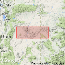
Named as one of six members of the Blackhawk formation for exposures near the town of Sunnyside, Carbon Co, UT in the Uinta basin. No type locality designated. Overlies the newly named Kenilworth member of Blackhawk. Underlies the newly named Grassy member of Blackhawk. Cross sections. Consists of a basal buff, medium-grained, massive sandstone that may be as much as 50 ft thick and an overlying sandstone, shale and coal sequence 25 ft thick. The upper coal-bearing rocks are replaced eastward by offshore bar sandstones. The highest and most extensive sandstone tongues into Mancos shale near Horse Canyon east of Green River, south of Sunnyside in Emery Co, UT in the Paradox basin. Includes the "Lower Sunnyside coal" 5 ft thick, and 30 to 35 ft above the lower coal is the "Upper Sunnyside coal" 22 ft thick. Late Cretaceous age.
Source: GNU records (USGS DDS-6; Denver GNULEX).
- Usage in publication:
-
- Sunnyside Member*
- Modifications:
-
- Principal reference
- Revised
- Dominant lithology:
-
- Sandstone
- Siltstone
- AAPG geologic province:
-
- Uinta basin
Summary:
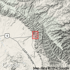
Is 1 of 5 members of Blackhawk Formation of Mesaverde Group in report area. Both contacts revised on basis of lithologic continuity, mappability, and topographic expression. Lower contact placed at base of continuous cliff-forming sandstone above lower mudstone member of Blackhawk. Upper contact placed at top of same type of sandstone just below Sunnyside coal. The coal bed which was part of Young's Sunnyside Member is reassigned to overlying upper mudstone member of Blackhawk. Principal reference section designated, measured in cliff north Sunnyside in NE1/4 sec 6, T15S, R14E, Carbon Co, UT, Uinta basin, where member: 1) overlies Mancos Shale; 2) underlies upper mudstone member of Blackhawk; 3) 190 ft thick; 4) consists of yellow to gray-yellow, very fine grained, silty carbonaceous sandstone. Interbedded gray, sandy, clayey, carbonaceous, thin- to cross-bedded siltstone in lower 57 ft thick unit. Some sandstone beds calcareous, cross-bedded, ripple cross laminated. Some beds burrowed and mottled. Basal sandstone and interbedded siltstone probably deposited in offshore, delta-platform environment below wave base that received periodic surges of active sedimentation. Thin-bedded facies probably upper delta platform, distributary-mouth-bar and littoral subenvironments. Upper sandstone facies represents channel-fill deposition by distributaries in upper delta. Late Cretaceous age. Nomenclature chart; cross section; geologic map.
Source: GNU records (USGS DDS-6; Denver GNULEX).
For more information, please contact Nancy Stamm, Geologic Names Committee Secretary.
Asterisk (*) indicates published by U.S. Geological Survey authors.
"No current usage" (†) implies that a name has been abandoned or has fallen into disuse. Former usage and, if known, replacement name given in parentheses ( ).
Slash (/) indicates name conflicts with nomenclatural guidelines (CSN, 1933; ACSN, 1961, 1970; NACSN, 1983, 2005, 2021). May be explained within brackets ([ ]).