

- Usage in publication:
-
- Sunlight Group*
- Modifications:
-
- Named
- Dominant lithology:
-
- Andesite
- Basalt
- Volcaniclastics
- AAPG geologic province:
-
- Montana folded belt
- Yellowstone province
- Bighorn basin
Summary:
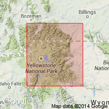
Named for Sunlight Creek (the type area), as the middle group of Absaroka Volcanic Supergroup (new). Is a sequence of mainly dark-colored pyroxene andesite lava flows and volcaniclastic rocks and potassic basalts. The creek flows through a major vent area east of Yellowstone Park and through the thickest accumulation of the group. Comprises (ascending order): Mount Wallace Formation (new) and its Slough Creek Tuff Member (new); Crescent Hill Basalt (new); Wapiti Formation and its Jim Mountain Member; and Trout Peak Trachyandesite and its Pacific Creek Tuff Member (new). Rocks of Sunlight Group disappear southward beneath Thorofare Creek Group (new, younger part of Absaroka Supergroup). Is entirely of early Bridgerian, middle Eocene age.
Source: GNU records (USGS DDS-6; Denver GNULEX).
For more information, please contact Nancy Stamm, Geologic Names Committee Secretary.
Asterisk (*) indicates published by U.S. Geological Survey authors.
"No current usage" (†) implies that a name has been abandoned or has fallen into disuse. Former usage and, if known, replacement name given in parentheses ( ).
Slash (/) indicates name conflicts with nomenclatural guidelines (CSN, 1933; ACSN, 1961, 1970; NACSN, 1983, 2005, 2021). May be explained within brackets ([ ]).