The National Geologic Map Database is migrating to a new infrastructure. We apologize for any service disruptions during this process.
|
|---|


- Usage in publication:
-
- Sun Valley Group*
- Modifications:
-
- Named
- Dominant lithology:
-
- Conglomerate
- Limestone
- Siltstone
- Sandstone
- AAPG geologic province:
-
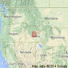
- Snake River basin
- Idaho Mountains province
Summary:
Name applied to rocks coeval, laterally contiguous, genetically related, separately mapped as Wood River, Grand Prize, Dollarhide Formations in central, north, south parts respectively late Paleozoic Wood River basin, sc. ID. Area of distribution for these 3 extends from Bellevue, Blaine Co, Snake River basin north to White Cloud Peak, Custer Co, Idaho Mountains province, and between Idaho batholith on west to Pioneer core complex on east. Named for town of Sun Valley. Initial deposition Desmoinesian. Deposition continued into Leonardian. Includes: conglomerate, bioclastic limestone, banded micritic sandstone, carbonaceous siltstone, graded silty micrite, massive silty micrite, sandy micrite, micritic sandstone; separable into basal conglomerate, middle fine-grained silty micrite, upper thin-bedded silty micrite facies representing deposits of subaqueous photic-zone braid delta and adjacent slope (basal part) to sub-wave base distal submarine ramp to mixed carbonate-silicilastic apron and basin (middle, upper parts). Is 2,000-3,000 m thick. Grand Prize and Dollarhide metamorphosed to sillimanite grade near batholith; metamorphic event 83.9 +/-3.4 Ma. Unconformably overlies Milligen Formation and deformed Salmon River assemblage. Unconformably underlies Challis Volcanic Group or Eocene conglomerate of Smiley Creek. Age = rocks Oquirrh Fm, Snaky Canyon Fm, Wells Fm. Geologic map; stratigraphic charts; fossils listed.
Source: GNU records (USGS DDS-6; Denver GNULEX).
For more information, please contact Nancy Stamm, Geologic Names Committee Secretary.
Asterisk (*) indicates published by U.S. Geological Survey authors.
"No current usage" (†) implies that a name has been abandoned or has fallen into disuse. Former usage and, if known, replacement name given in parentheses ( ).
Slash (/) indicates name conflicts with nomenclatural guidelines (CSN, 1933; ACSN, 1961, 1970; NACSN, 1983, 2005, 2021). May be explained within brackets ([ ]).