The National Geologic Map Database is migrating to a new infrastructure. We apologize for any service disruptions during this process.
|
|---|


- Usage in publication:
-
- Sun River dolomite
- Modifications:
-
- First used
- Dominant lithology:
-
- Limestone
- Dolomite
- AAPG geologic province:
-
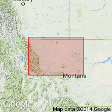
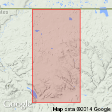
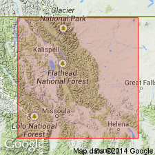
- Sweetgrass arch
Summary:
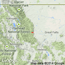
Is upper formation of Madison group, equivalent to Charles formation of central MT. Lies conformably above the Mission Canyon formation on the Sweetgrass arch. Is well exposed along the Sun River west of Great Falls in Hanna Gulch, Teton Co, MT. Name credited to C. E. Erdmann [but definition never published by him]. Consists of very light yellowish-white dolomitic limestone and limy dolomite with an occasional bed of chert. Is believed to correlate with Charles formation of central MT, although it lacks evaporites found in Charles and with middle part of Rundle limestone of Alberta. Thought to be equivalent to MA unit of Sloss and Laird. Probably bears same age as Charles--Meramec, or Mississippian age. May be present in subsurface west of Sweetgrass arch.
Source: GNU records (USGS DDS-6; Denver GNULEX).
- Usage in publication:
-
- Sun River dolomite
- Modifications:
-
- First used
- Dominant lithology:
-
- Dolomite
- Limestone
- AAPG geologic province:
-
- Sweetgrass arch
Summary:
Is the upper unit of Madison formation on the Sweetgrass arch. [Author applied formation rank rather than group rank to Madison.] Composed of gray to buff-white dolomite and dolomitic limestone; dolomite is medium to coarsely crystalline, fossiliferous, contains thin, dense, argillaceous dolomite near top; gray chert found in dense dolomite beds. Is 355 ft thick. Is conformably above Mission Canyon limestone of Madison and disconformably underlies Jurassic Sawtooth formation. Correlates with MA units of Sloss and Laird. Assigned to the Mississippian.
Source: GNU records (USGS DDS-6; Denver GNULEX).
- Usage in publication:
-
- Sun River Member*
- Modifications:
-
- Revised
- AAPG geologic province:
-
- Sweetgrass arch
Summary:
Reduced in stratigraphic rank from formation as upper member of Castle Reef Dolomite (new name), of Madison Group in Sun River Canyon area, on the Sweetgrass arch and in the Montana folded belt province. Composed almost entirely of dolomite, mostly fine- to medium-crystalline, light tan-gray. Lower part is medium to coarsely crystalline at type. Thickness variable due to pre-Jurassic erosion; ranges from 250-330 ft thick. Overlies lower member of Castle Reef; unconformably underlies Jurassic Ellis Group. Is fossiliferous (corals). Is of Meramec, or Late Mississippian age.
Source: GNU records (USGS DDS-6; Denver GNULEX).
- Usage in publication:
-
- Sun River Member*
- Modifications:
-
- Not used
Summary:
Not used as a stratigraphic term in this report on the Sawtooth Range of the Montana folded belt province and the Sweetgrass arch because of the variable position of its basal contact. Lower contact has been placed between the top of a secondary dolomite and base of a limestone. Stratigraphic depth of secondary dolomitization varies in the range. May be a useful term for the pervasively dolomitized rocks forming the upper part of the Mississippian Madison Group. Rocks of Meramecian age that have been called Sun River are assigned to the upper part of Gateway Pass and overlying Dupuyer units of the Castle Reef Formation.
Source: GNU records (USGS DDS-6; Denver GNULEX).
For more information, please contact Nancy Stamm, Geologic Names Committee Secretary.
Asterisk (*) indicates published by U.S. Geological Survey authors.
"No current usage" (†) implies that a name has been abandoned or has fallen into disuse. Former usage and, if known, replacement name given in parentheses ( ).
Slash (/) indicates name conflicts with nomenclatural guidelines (CSN, 1933; ACSN, 1961, 1970; NACSN, 1983, 2005, 2021). May be explained within brackets ([ ]).