

- Usage in publication:
-
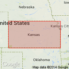
- Sumner division
- Modifications:
-
- Named
- Dominant lithology:
-
- Shale
- Limestone
- Dolomite
- Gypsum
- AAPG geologic province:
-
- Sedgwick basin
Summary:
Named as the Sumner division of the Big Blue series (new) for Sumner Co, KS in the Sedgwick basin. No type locality designated. Divided into newly named Geuda salt-measures (base) and Wellington shales (top). Consists of shale, gypsum, limestone, and dolomite. The Geuda ranges from 300 to 400 ft thick. The Wellington ranges from 250 to 450 ft thick. Overlies Chase limestones of Flint Hills division. Underlies Harper sandstones (new) of Salt Fork division (new) of Cimarron series (new). Of Permian age.
Source: GNU records (USGS DDS-6; Denver GNULEX).

- Usage in publication:
-
- Sumner group
- Modifications:
-
- Overview
- AAPG geologic province:
-
- Nemaha anticline
- Sedgwick basin
- Salina basin
- Chautauqua platform
- Anadarko basin
Summary:
Sumner group. Includes (descending) Wellington formation (not exposed in Nebraska), Pearl shale, Herington limestone, Enterprise shale, and Luta limestone. Overlies Chase group. Age is Permian (Big Blue).
Source: GNC KS-NE Permian Corr. Chart, Oct. 1936.

- Usage in publication:
-
- Sumner group*
- Modifications:
-
- Areal extent
- AAPG geologic province:
-
- Anadarko basin
Summary:
Extended as an undivided unit into the subsurface of Baca County, Colorado, in the Anadarko basin, east of the Las Animas arch. Overlies Chase group (undivided) and underlies Nippewalla group (undivided). Age is Early Permian (Leonardian). Report includes correlation chart.
Source: Modified from GNU records (USGS DDS-6; Denver GNULEX).
For more information, please contact Nancy Stamm, Geologic Names Committee Secretary.
Asterisk (*) indicates published by U.S. Geological Survey authors.
"No current usage" (†) implies that a name has been abandoned or has fallen into disuse. Former usage and, if known, replacement name given in parentheses ( ).
Slash (/) indicates name conflicts with nomenclatural guidelines (CSN, 1933; ACSN, 1961, 1970; NACSN, 1983, 2005, 2021). May be explained within brackets ([ ]).