- Usage in publication:
-
- Sulphur Peak Member
- Modifications:
-
- Named
- Dominant lithology:
-
- Andesite
- AAPG geologic province:
-
- Great Basin province
Summary:
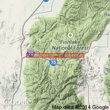
Named as a member of Bullion Canyon Volcanics for Sulphur Peak, Millard Co, UT, Great Basin province. No type locality designated. Is an andesite flow with euhedral phenocrysts of plagioclase and hornblende up to a cm in length. Groundmass is commonly gray but locally yellow, red, or purple. Flow structures common. Is several hundred meters thick at Sulphur Peak. Has a distinctive horizontal and westerly magnetic direction. Is overlain by sequence of flows and ash-flows of the Bullion Canyon. Assigned an Oligocene age. Geologic map.
Source: GNU records (USGS DDS-6; Denver GNULEX).
For more information, please contact Nancy Stamm, Geologic Names Committee Secretary.
Asterisk (*) indicates published by U.S. Geological Survey authors.
"No current usage" (†) implies that a name has been abandoned or has fallen into disuse. Former usage and, if known, replacement name given in parentheses ( ).
Slash (/) indicates name conflicts with nomenclatural guidelines (CSN, 1933; ACSN, 1961, 1970; NACSN, 1983, 2005, 2021). May be explained within brackets ([ ]).

