

- Usage in publication:
-
- Sully member
- Modifications:
-
- Named
- Dominant lithology:
-
- Shale
- AAPG geologic province:
-
- Williston basin
- Sioux uplift
Summary:
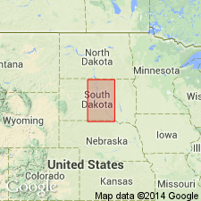
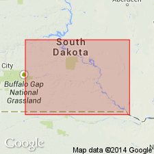
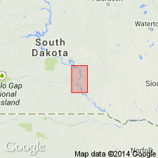
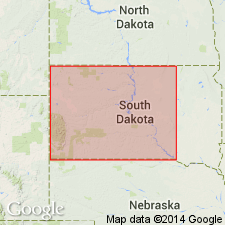
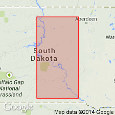
Named as a member of Pierre formation for characteristic exposures along both sides of Missouri River in and opposite Sully Co, SD. Subdivided (ascending) into the Agency shale [unranked], Oacoma zone (new), and Verendrye beds (new). Type section measured south of Little Bend, just west of where Missouri River can be seen both northeast and southwest of the road in western Sully Co opposite the site of Old Fort Bennett in Williston basin. Is 233 ft thick at type section. Agency shale at base consists of light-gray, siliceous shale containing two or more bentonite streaks, and beds of light-medium-gray concretions; is 78 ft thick. Oacoma zone in middle consists of light-gray and darker gray probably bentonitic shale in alternating beds, and beds of black and purplish-black manganiferous concretions; is 45 ft thick. Verendrye beds at the top consist of light- to medium-gray, brown-weathering shale, containing tabular ferruginous concretions; is 110 ft thick. Agency shale absent south of Crow Creek, Buffalo Co, SD. Thickness of the member varies from 134 ft to a probable 315 ft in central SD. Overlies Gregory member (new); overlain by Virgin Creek member (new) of Pierre. Lists fossils, gives representative sections, and shows outcrop in Missouri River valley, SD in Williston basin and on Sioux uplift. Cretaceous in age.
Source: GNU records (USGS DDS-6; Denver GNULEX).
- Usage in publication:
-
- Sully member
- Modifications:
-
- Revised
- AAPG geologic province:
-
- Sioux uplift
- Williston basin
Summary:
A member of the Pierre formation. Revised to include the Gregory marl [unranked] (formerly upper Gregory member) as a subdivision at the base. The member, as revised includes (ascending): the Gregory marl, Agency shale, Oacoma zone, and Verendrye beds north of Crow Creek, Buffalo Co, SD on the Sioux uplift. It includes the Gregory marl, Oacoma zone, and Verendrye beds south of Crow Creek where Agency shale is absent. Cretaceous in age.
Source: GNU records (USGS DDS-6; Denver GNULEX).
- Usage in publication:
-
- Sully member
- Modifications:
-
- Revised
- AAPG geologic province:
-
- Sioux uplift
- Williston basin
Summary:
Basal sand and associated chalky beds are named the Crow Creek zone (new) of the Sully member of Pierre formation in Buffalo Co, SD, in the Missouri River valley on the Sioux uplift. Previously correlated with Gregory chalk [Gregory marl of Searight, 1938] in Rosebud bridge section [Gregory Co, SD on the Sioux uplift]. There are actually two calcareous zones in the Gregory Co section, and the Sully marl [Crow Creek zone of Buffalo Co] is correlated with the upper, previously overlooked one rather than with the lower or Gregory chalk. Member thus includes (ascending): the Crow Creek, Agency, Oacoma, and Verendrye zones. Underlain by the Gregory member (redefined); overlain by the Virgin Creek member. Cretaceous in age.
Source: GNU records (USGS DDS-6; Denver GNULEX).
- Usage in publication:
-
- Sully member
- Modifications:
-
- Revised
- AAPG geologic province:
-
- Williston basin
- Sioux uplift
Summary:
A member of the Pierre formation. Combines the terms Agency shale zone and Oacoma zone for a subdivision of the Sully member lying above the Crow Creek zone and below the Verendrye zone in the Missouri River valley, SD, on the Sioux uplift and in the Williston basin.
Source: GNU records (USGS DDS-6; Denver GNULEX).
- Usage in publication:
-
- Sully member*†
- Modifications:
-
- Abandoned
- AAPG geologic province:
-
- Sioux uplift
- Williston basin
Summary:
Name abandoned for a member of the Pierre shale in the Missouri River valley, SD on Sioux uplift and in Williston basin. Substituted (ascending) the Crow Creek, DeGrey (new), and Verendrye members. These units were formerly the Crow Creek, Agency-Oacoma, and Verendrye zones, respectively, of the Sully member (Gries, 1941).
Source: GNU records (USGS DDS-6; Denver GNULEX).
For more information, please contact Nancy Stamm, Geologic Names Committee Secretary.
Asterisk (*) indicates published by U.S. Geological Survey authors.
"No current usage" (†) implies that a name has been abandoned or has fallen into disuse. Former usage and, if known, replacement name given in parentheses ( ).
Slash (/) indicates name conflicts with nomenclatural guidelines (CSN, 1933; ACSN, 1961, 1970; NACSN, 1983, 2005, 2021). May be explained within brackets ([ ]).