

- Usage in publication:
-
- Sullivan Siltstone Member
- Modifications:
-
- Principal reference
- Dominant lithology:
-
- Siltstone
- Shale
- AAPG geologic province:
-
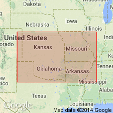
- Ozark uplift
Summary:
Pg. 6-8. Sullivan Siltstone Member of Bonneterre Formation. Name proposed for the lower member [of 2] in the upper part of the Bonneterre Formation; had been applied informally by mining company geologists working in southeastern Missouri and the Viburnam Trend for many years. Overlies unnamed "oolite facies" or "micrite and shale facies" of the Bonneterre. Contact is usually sharp and is unconformable in places. Underlies Whetstone Creek Member (new) of the Bonneterre. The Sullivan Siltstone Member is widespread in subsurface; the only surface exposure is at type section. At type section, is 22 feet thick and consists of dolomitic siltstone. At reference section, is 38 feet thick and consists of limy, light-gray siltstone interbedded with abundant, thin, greenish-gray shale beds. In the lower half of the interval, low amplitude styolites filled with green shale are common. "Pepper" glauconite is common throughout. Age is Late Cambrian (Dresbachian), [based on fossils]. The Sullivan is within the upper CREPICEPHALUS Zone through middle APHELASPIS Zone. Report includes measured section, core descriptions, cross section, stratigraphic chart.
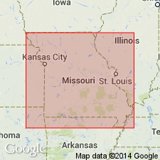
Type section (surface; = Whetstone Creek reference): Crooked Creek cryptoexplosive structure in center E/2 NW/4 sec. 17, T. 36 N., R. 4 W., Crawford Co., MO (this is the only surface exposure of this unit). Named from town of Sullivan, Franklin Co., MO, which is located 38 mi north of type section, just north of the Franklin-Crawford Co. line.
Reference section (subsurface): depth-interval 1,495.0 to 1,533.0 ft, St. Joe Minerals Corporation Core No. 64W63 (WR-1), SE/4 SE/4 sec. 16, T. 29 N., R. 13 W., Wright Co., MO.
Source: Missouri lexicon (Thompson, 2001, Missouri Geol. Survey Rpt. Inv., no. 73, p. 278-279); GNU records (USGS DDS-6; Denver GNULEX); US geologic names lexicon (USGS Bull. 1520, p. 298).

- Usage in publication:
-
- Sullivan Siltstone Member
- Modifications:
-
- Overview
- AAPG geologic province:
-
- Ozark uplift
Summary:
Pg. 19. Sullivan Siltstone Member of Bonneterre Formation. Kurtz et al. (1975, p. 13) stated: "This unit is a variably micritic, generally laminated siltstone. Local layers of calcarenites and mud-chip conglomerates are present. The high volumes of quartz silt with local concentrations of fine quartz sand and glauconite are believed to more strongly reflect the provenance of the sediment than any significant changes in water depth. The base of the unit is usually in sharp contact with the subjacent stratum…This contact is interpreted as profoundly diachronous, being coincident with the boundary between the APHELASPIS and CREPICEPHALUS zones…" "The lower part of the siltstone is unique in showing a nearly complete absence of burrowing. The upper part of the siltstone may change facies to a moderately burrowed micrite unit containing some shale beds…The Sullivan Siltstone Member is the 'upper marker bed' in the Bonneterre Formation referred to by Gerdemann and Myers (1972, [Econ. Geol., v. 67], p. 430; fig. 5, p. 431)."
Source: Publication.
- Usage in publication:
-
- Sullivan Siltstone Member
- Modifications:
-
- Overview
- AAPG geologic province:
-
- Ozark uplift
Summary:
Pg. 278-279. Sullivan Siltstone Member of the Bonneterre Formation overlies the main carbonate portion of the Bonneterre, and [underlies] the Whetstone Creek Member of the Bonneterre. Age is Late Cambrian.
Source: Publication.
- Usage in publication:
-
- Sullivan Siltstone Member*
- Modifications:
-
- Age modified
- Biostratigraphic dating
- AAPG geologic province:
-
- Ozark uplift
Miller, J.F., Evans, K.R., Kurtz, V.E., and Repetski, J.E., 2013, Biostratigraphy and sequence stratigraphy of Cambrian and lowest Ordovician strata in Missouri; Chapter 2: Missouri Geological Survey Report of Investigations, no. 70, pt. 1 (revised), p. 13-24.
Summary:
Pg. 14 (fig. 2-1), 15 (fig. 2-2), 17. Sullivan Siltstone Member of Bonneterre Formation. Present in southeastern Missouri. Thickness 15 to 78 feet. Unconformably lies above unnamed lower part of Bonneterre (= informal Lamotte-Bonneterre "transition beds" and unnamed main carbonate member); lies below Whetstone Creek Member of Bonneterre. Age is latest Middle Cambrian to earliest Late Cambrian (early Croixan; latest Lincolnian to earliest Millardan; latest Marjuman to earliest Steptoean), based on fossils. Ranges from uppermost CREPICEPHALUS to lower APHELASPIS trilobite zone; top is within the ANGULOTRETA MISSOURIENSIS brachiopod zone.
Source: Publication.
- Usage in publication:
-
- Sullivan Siltstone Member*
- Modifications:
-
- Areal extent
- AAPG geologic province:
-
- Ozark uplift
Thompson, T.L., Mulvany, P.S., Palmer, J.R., Davis, J.G., and Miller, J.F., 2013, Cambrian stratigraphic succession in Missouri; Chapter 3: Missouri Geological Survey Report of Investigations, no. 70, pt. 1 (revised), p. 25-266.
Summary:
Pg. 38 (fig. 3-4), 116-121, 219 (App. A). Sullivan Siltstone Member of Bonneterre Formation. Is in upper part of Bonneterre, disconformably overlying unnamed lower part of formation; underlies Whetstone Creek Member of Bonneterre. Occurs in subsurface of Crawford County southwestward into Taney County, southern Missouri; thickness ranges from 15 to 78 feet. Reference section of Kurtz and others (1975) is redescribed with more detail. Consists of buff to gray, ripple laminated to cross-bedded, very fine-grained sandstone-siltstone with calcareous cement. Thin conglomerate beds occur near top and in middle; thin shales occur in lower part. Basal 10 inches is cross-bedded sandstone; base = scoured surface. Total thickness about 38 feet. Age is latest Middle to earliest Late Cambrian (latest Lincolnian to earliest Millardan; latest Marjuman to earliest Steptoean).
Source: Publication.
For more information, please contact Nancy Stamm, Geologic Names Committee Secretary.
Asterisk (*) indicates published by U.S. Geological Survey authors.
"No current usage" (†) implies that a name has been abandoned or has fallen into disuse. Former usage and, if known, replacement name given in parentheses ( ).
Slash (/) indicates name conflicts with nomenclatural guidelines (CSN, 1933; ACSN, 1961, 1970; NACSN, 1983, 2005, 2021). May be explained within brackets ([ ]).