The National Geologic Map Database is migrating to a new infrastructure. We apologize for any service disruptions during this process.
|
|---|


- Usage in publication:
-
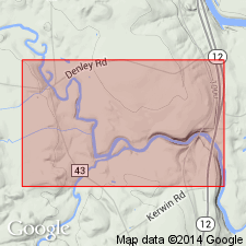
- Sugar River Limestone
- Modifications:
-
- Named
- Dominant lithology:
-
- Limestone
- AAPG geologic province:
-
- Appalachian basin
Summary:
Thin-bedded, fossiliferous, shaly calcarenite and calcisiltite on Sugar River in Lewis Co., NY, here named Sugar River Limestone. 12 m thick at type section. Overlies Kings Fall Limestone and underlies Camp Member of Denley Limestone.
Source: GNU records (USGS DDS-6; Reston GNULEX).
- Usage in publication:
-
- Sugar River Limestone
- Modifications:
-
- Overview
- AAPG geologic province:
-
- Appalachian basin
Summary:
Authors feel a refined, unified Trenton stratigraphy is essential. Applied here is a modified version of Kay's (1968) stratigraphic nomenclature. Rathbun Member occurs at the top of the Sugar River and underlies City Book bed (informal) of Poland Member of Denley Limestone. Rathbun overlies undifferentiated Sugar River consisting of shaly, wacke- to packstones. Massive upper Sugar River strata, probably correlative with the Rathbun Member, crop out in the Lowville area, 6i6 km northwest of Gravesville, though Chenoweth (1952) did not recognize the Rathbun in the Black River Valley.
Source: GNU records (USGS DDS-6; Reston GNULEX).
For more information, please contact Nancy Stamm, Geologic Names Committee Secretary.
Asterisk (*) indicates published by U.S. Geological Survey authors.
"No current usage" (†) implies that a name has been abandoned or has fallen into disuse. Former usage and, if known, replacement name given in parentheses ( ).
Slash (/) indicates name conflicts with nomenclatural guidelines (CSN, 1933; ACSN, 1961, 1970; NACSN, 1983, 2005, 2021). May be explained within brackets ([ ]).