

- Usage in publication:
-
- Sucker Creek Formation
- Modifications:
-
- Overview
- AAPG geologic province:
-
- Snake River basin
Summary:
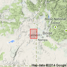
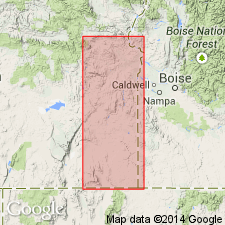
Mapped in Mitchell Butte 30' quad, eastern OR and western ID. exposed on the southern and eastern flanks of Owyhee Ridge, along the Owyhee Reservoir near Hole-in-the-Ground and as small window in overlying Owyhee basalt northwest of Blackjack Butte. Detailed lithology, depositional environment, age, and correlation discussed. Age is Miocene based on fossils.
Source: GNU records (USGS DDS-6; Menlo GNULEX).
- Usage in publication:
-
- Sucker Creek formation
- Modifications:
-
- First used
- Dominant lithology:
-
- Volcaniclastics
- Basalt
- Rhyolite
- Tuff
- AAPG geologic province:
-
- Snake River basin
Summary:
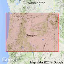
Sucker Creek formation. Name applied to mixed pyroclastic and sedimentary rocks as much as 1,600 feet thick in Owyhee Reservoir area in southeastern Oregon, adjacent to Idaho border. Includes Leslie Gulch tuff member, as much as 1,000 feet thick; consists of extrusive basalt and rhyolite, and deposit of ash-flow tuff. Sucker Creek underlies Jump Creek rhyolite and unconformably underlies Owyhee basalt. Age is Miocene based on Barstovian mammalian fauna.
Source: Modified from GNU records (USGS DDS-6; Menlo GNULEX).
- Usage in publication:
-
- Sucker Creek Formation
- Modifications:
-
- Named
- Dominant lithology:
-
- Tuff
- Volcaniclastics
- AAPG geologic province:
-
- Snake River basin
Summary:
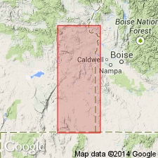
Named for exposures along Sucker Creek. Measured type section designated in S/2 SW/4 sec. 28 and NE/4 NW/4 sec. 33, T24S R46E, Malheur Co., OR. Exposed extensively in Owyhee Reservoir district. Consists of altered tuffs and volcanic sandstones, vitric tuffs, arkose sandstones, granite-cobble conglomerates, and carbonaceous volcanic shales. Contains Leslie Gulch Ash-Flow Tuff Member (new) in upper part. Is 590 ft thick at type section; total thickness may be 1600 ft. Age is late Miocene based on Barstovian mammalian fossils of Sucker Creek fauna collected near type by Scharf (1935) and by J.A. Shotwell (written commun., Apr., 1961). Unit contains Succor (sic) Creek flora of Mascall age (middle late Miocene, Chaney, 1959). Radiometric (K-Ar) age of 16.7 Ma was obtained from basalt in unit (Evernden and James, 1964).
Source: GNU records (USGS DDS-6; Menlo GNULEX).
- Usage in publication:
-
- Sucker Creek Formation
- Modifications:
-
- Age modified
- AAPG geologic province:
-
- Snake River basin
Summary:
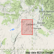
Mapped in Owyhee region, Malheur Co, OR. Leslie Gulch Ash-Flow Tuff Member shown separately from three lithologies of formation also shown separately. Age is Miocene.
Source: GNU records (USGS DDS-6; Menlo GNULEX).
- Usage in publication:
-
- Sucker Creek Formation
- Modifications:
-
- Overview
- AAPG geologic province:
-
- Snake River basin
Summary:
Detailed description of Sucker Creek Formation and Leslie Gulch Ash-Flow Tuff [also referred to as Leslie Gulch Member and Leslie Gulch Tuff]. Spelling of Sucker Creek Formation is explained in that it was named from maps showing "Sucker Creek" before U.S. Board on Geographic Names changed name of creek to "Succor Creek" in recognition of earlier usage.
Source: GNU records (USGS DDS-6; Menlo GNULEX).
- Usage in publication:
-
- Sucker Creek Formation
- Modifications:
-
- Geochronologic dating
- AAPG geologic province:
-
- Snake River basin
Summary:
Sucker Creek Formation. Samples from vitric tuff collected along Succor Creek, just south of Succor Creek Gorge, in S/2 SW/4 sec. 28, T. 24 S., R. 46 E., Mitchell Butte (1905) 30-min quadrangle, Malheur County, Oregon. Collector: L.R. Kittleman. K-Ar age 18.5 +/-1.7 Ma (glass chard) and 15.4 +/-0.9 Ma (sanidine).
Source: Modified from GNU records (USGS DDS-6; Menlo GNULEX).
- Usage in publication:
-
- Succor Creek Formation
- Modifications:
-
- Biostratigraphic dating
- AAPG geologic province:
-
- Snake River basin
Summary:
Succor Creek Formation (also referred to as Sucker Creek Formation on sketch map of Weiser area, Washington Co, ID) is exposed in Olds Ferry area to west of Weiser, 1200-ft section measured by Shah (1966 unpub. thesis) contains 800 ft of basalt flows and about 400 ft of sedimentary interbeds. Sedimentary deposits are mostly well-indurated lithic shales of pale yellowish pink to light gray color. List of Succor Creek flora of middle Miocene age included in report.
Source: GNU records (USGS DDS-6; Menlo GNULEX).
- Usage in publication:
-
- Succor Creek Formation
- Modifications:
-
- Biostratigraphic dating
- AAPG geologic province:
-
- Snake River basin
Summary:
Beds named Payette Formation by Lindgren (1900) "Now referred to as Sucker (Succor) Creek Formation (Kittleman, 1962; Kittleman and others, 1966; Baldwin, 1964; and Corcoran, 1965)". p. 8. Name "Succor" Creek now official. Age is middle to late Miocene on basis of fossils [plants and vertebrates]. [article is reprinted from The Ore Bin, v. 28, no. 10, p. 173-181 (Oct. 1966)]
Source: GNU records (USGS DDS-6; Menlo GNULEX).
For more information, please contact Nancy Stamm, Geologic Names Committee Secretary.
Asterisk (*) indicates published by U.S. Geological Survey authors.
"No current usage" (†) implies that a name has been abandoned or has fallen into disuse. Former usage and, if known, replacement name given in parentheses ( ).
Slash (/) indicates name conflicts with nomenclatural guidelines (CSN, 1933; ACSN, 1961, 1970; NACSN, 1983, 2005, 2021). May be explained within brackets ([ ]).