The National Geologic Map Database is migrating to a new infrastructure. We apologize for any service disruptions during this process.
|
|---|


- Usage in publication:
-
- Stumptown Member*
- Modifications:
-
- Named
- Dominant lithology:
-
- Gravel
- Clay
- Sand
- AAPG geologic province:
-
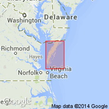
- Atlantic Coast basin
Summary:
The lower sandy gravel, clay-silt, and fine sand sequence of the Nassawadox Formation is here named the Stumptown Member. It is entirely subsurface and contains three distinct lithofacies, units A, B, and C. Unconformably overlies the Eastover and Yorktown Formations; conformably to disconformably underlies the Butlers Bluff Member of the Nassawadox. Thickness at type section is 140 ft (43 m). Age is Pleistocene.
Source: GNU records (USGS DDS-6; Reston GNULEX).
For more information, please contact Nancy Stamm, Geologic Names Committee Secretary.
Asterisk (*) indicates published by U.S. Geological Survey authors.
"No current usage" (†) implies that a name has been abandoned or has fallen into disuse. Former usage and, if known, replacement name given in parentheses ( ).
Slash (/) indicates name conflicts with nomenclatural guidelines (CSN, 1933; ACSN, 1961, 1970; NACSN, 1983, 2005, 2021). May be explained within brackets ([ ]).