- Usage in publication:
-
- Stump Arroyo member
- Modifications:
-
- Original reference
- Dominant lithology:
-
- Gravel
- Sand
- AAPG geologic province:
-
- Anadarko basin
Summary:
Pg. 69 (fig. 1), 71-73. Stump Arroyo member of Crooked Creek formation. Name applied to basal part of Crooked Creek formation. Consists of coarse sand, reddish to light tan, and well sorted, containing white quartz pebbles; grades upward into finer more poorly sorted sand, with calcareous nodules at top. Thickness a little more than 10 feet. Unconformably overlies Missler member (new) of Meade formation (redefined). In some areas where the Crooked Creek is not extensively developed, Pearlette Ash member rests directly on the Stump Arroyo. Age is Pleistocene.
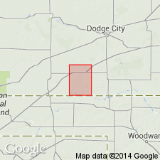
Type locality: in sec. 21, T. 38 S., R. 28 W., Meade Co., southwestern KS. Gravels of member form high surface rubble in sec. 10, T. 33 S., R. 29 W., along tributary of Stump Arroyo north of the Deer Park and west of the northwest corner of Deer Park. Named from tributary of Crooked Creek which flows through Meade County State Park and empties into Crooked Creek, in sec. 29, T. 33 S., R. 28 W.
Source: US geologic names lexicon (USGS Bull. 1200, p. 3757).

- Usage in publication:
-
- Stump Arroyo member
- Modifications:
-
- Areal extent
- AAPG geologic province:
-
- Anadarko basin
Summary:
Pg. 55 (fig. 1), 57. Stump Arroyo member of Crooked Creek formation. Underlies Atwater member (new). Age is Pleistocene.
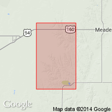
Study area: Meade Co., southwestern KS.
Source: US geologic names lexicon (USGS Bull. 1200, p. 3757).
- Usage in publication:
-
- Stump Arroyo Gravel Member
- Modifications:
-
- Age modified
- Biostratigraphic dating
- AAPG geologic province:
-
- Anadarko basin
Zakrzewski, R.J., 1975, Pleistocene stratigraphy and paleontology in western Kansas; The state of the art, 1974: University of Michigan, Museum of Paleontology Papers on Paleontology, no. 12., Claude W. Hibbard Memorial Volume, no. 3
Summary:
Pg. 122 (fig. 1), 124 (fig. 2), 125 (fig. 3). Stump Arroyo Gravel Member of Crooked Creek Formation. Lies below Atwater Silt Member and above Missler Silt Member of Ballard Formation. Fossils (Seger local fauna). Age is Pliocene (Blancan NALMA); Pliocene-Pleistocene boundary placed at base of Irvingtonian NALMA (base of Nebraskan-Aftonian), = 1.8 Ma.
Source: Publication.

- Usage in publication:
-
- Stump Arroyo Member*
- Modifications:
-
- Biostratigraphic dating
- Mapped 1:24k
- AAPG geologic province:
-
- Anadarko basin
Summary:
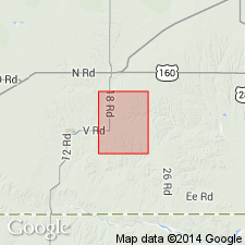
Stump Arroyo Member of Crooked Creek Formation. Unconsolidated sand and gravel. Thickness 0 to 10 m. Fossils (vertebrates). Age is Pliocene (Blancan NALMA). [Pliocene-Pleistocene boundary placed at 1.8 Ma.]
Source: Publication.
- Usage in publication:
-
- Stump Arroyo Member*
- Modifications:
-
- Revised
- AAPG geologic province:
-
- Anadarko basin
Martin, R.A., Honey, J.G., and Pelaez-Camponanes, Pablo, 2000, The Meade basin [Kansas] rodent project; a progress report: Paludicola, v. 3, no. 1, p. 1-32.
Summary:
Stump Arroyo Member of Crooked Creek Formation. Overlies Pliocene Missler Member of Ballard Formation. Underlies Pliocene and Pleistocene Atwater Member of Crooked Creek. Fossils (Seger local fauna). Age is Pliocene (late Blancan NALMA), based on fossils. [Pliocene-Pleistocene boundary placed at 1.8 Ma; = Blancan-Irvingtonian boundary.]
Source: Publication.
For more information, please contact Nancy Stamm, Geologic Names Committee Secretary.
Asterisk (*) indicates published by U.S. Geological Survey authors.
"No current usage" (†) implies that a name has been abandoned or has fallen into disuse. Former usage and, if known, replacement name given in parentheses ( ).
Slash (/) indicates name conflicts with nomenclatural guidelines (CSN, 1933; ACSN, 1961, 1970; NACSN, 1983, 2005, 2021). May be explained within brackets ([ ]).

