- Usage in publication:
-
- Stuart shale*
- Modifications:
-
- First used
- Dominant lithology:
-
- Shale
- Sandstone
- Conglomerate
- Clay
- AAPG geologic province:
-
- Arkoma basin
Summary:
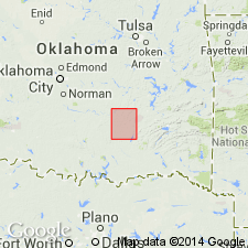
First published use of name. Intent to name not stated, and no type locality designated. Origin of name not stated. Is 275 ft thick in northeast and central part of Coalgate quad, Coal Co, OK, Arkoma basin, and about 100 ft in western part. Composed of three [informal] members: upper and lower ones of shale, separated by a variable sandstone 10-50 ft thick. In central part of quad, a thin sandstone and chert conglomerate lentil occurs in lower shale member. This lower member has a nearly constant thickness of about 120 ft from northeast corner of quad southwestward to within 10 mi of quad border where it begins to contract; at western border does not exceed 50 ft. Composed chiefly of bluish and black laminated clays. Crops out in a level, rolling tract bordering the timber belt of underlying Thurman sandstone on east. Upper member is composed of bluish shales, 10-120 ft thick. This shale, unlike lower member, crops out in steep slopes of the escarpments and hills which are surmounted by succeeding Senora formation (new), and is mostly wooded and concealed by talus. Sandstone member is sufficiently thick to be mapped, could it be located across quad. Forms flat-topped ridges and hills with eastward and southward-facing bluffs. To west gradually changes to thin shaly beds, and finally disappears. Columnar section. Geologic map. Shown as of Carboniferous age.
Source: GNU records (USGS DDS-6; Denver GNULEX).
For more information, please contact Nancy Stamm, Geologic Names Committee Secretary.
Asterisk (*) indicates published by U.S. Geological Survey authors.
"No current usage" (†) implies that a name has been abandoned or has fallen into disuse. Former usage and, if known, replacement name given in parentheses ( ).
Slash (/) indicates name conflicts with nomenclatural guidelines (CSN, 1933; ACSN, 1961, 1970; NACSN, 1983, 2005, 2021). May be explained within brackets ([ ]).

