

- Usage in publication:
-
- Stringtown shale*
- Modifications:
-
- Original reference
- Dominant lithology:
-
- Shale
- AAPG geologic province:
-
- Arkoma basin
- Ouachita folded belt
Summary:
Stringtown shale. Upper part black fissile cherty shale; lower part greenish fissile friable shales with occasional inclusions of calcareous cone-in-cone and ironstone concretions. Thickness 600 feet. Underlies Talihina chert. Base not defined. [In Arkansas the name has been used in a restricted sense.]
[Named from Stringtown, Atoka Co., southeastern OK.]
Source: US geologic names lexicon (USGS Bull. 896, p. 2076-2077).
- Usage in publication:
-
- Stringtown shale
- Modifications:
-
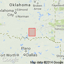
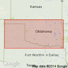
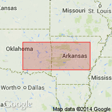
- Areal extent
- AAPG geologic province:
-
- Ouachita folded belt
Summary:
Stringtown shale. [Name applied in a restricted sense.] Consists of lower calcareous part and upper shaly part. Lower part, up to 75 feet thick, contains lenses of bluish limestone; is sometimes conglomeratic at base. Upper part, 50 to 75 feet thick, is soft black shale containing graphite; thin beds of chert and limestone occur near top. Total thickness 75 to 150 feet. Rests unconformably on Ouachita shale; underlies Bigfork chert. Fossils (graptolites). Age is Ordovician.
Source: Modified from GNU records (USGS DDS-6; Denver GNULEX).

- Usage in publication:
-
- Stringtown shale*
- Modifications:
-
- Biostratigraphic dating
Summary:
Pg. 677. Stringtown shale contains Normanskill fossils at 3 horizons. [The USGS classifies Normanskill as of Chazy and Middle(?) Ordovician age.]
Source: US geologic names lexicon (USGS Bull. 896, p. 2076-2077).
- Usage in publication:
-
- Stringtown shale
- Modifications:
-
- Age modified
- AAPG geologic province:
-
- Ouachita folded belt
Summary:
Pg. 23-31. Talihina chert and most of Stringtown shale were deposited in Ouachita Mountains while Viola limestone was being deposited in Arbuckle Mountains. Basal part of Stringtown is of Black River age and corresponds to upper part of Simpson formation.
Source: US geologic names lexicon (USGS Bull. 896, p. 2076-2077).
- Usage in publication:
-
- Stringtown shale*
- Modifications:
-
- Not used
- AAPG geologic province:
-
- Ouachita folded belt
Summary:
Pg. 67. The use of Stringtown shale has been discontinued in this area [Caddo Gap and DeQueen quadrangles, AR-OK] because the beds to which it has been applied do not form a mappable unit distinct from rest of shale above Blakely sandstone; because the graptolites supposed to be characteristic of it have apparently been found well down in underlying shale; and because, according to E.O. Ulrich, the limits and character of Stringtown shale at type locality in Oklahoma are in doubt. With recognition of Blakely sandstone as distinct formation, and failure to separate the Stringtown, it became necessary to give a new name (Womble shale) to whole interval between Blakely sandstone [below] and Bigfork chert [above].
Source: US geologic names lexicon (USGS Bull. 896, p. 2076-2077).
- Usage in publication:
-
- Stringtown shale*
- Modifications:
-
- Age modified
- AAPG geologic province:
-
- Arkoma basin
- Ouachita folded belt
Summary:
Pg. 34. Stringtown shale is Lower Ordovician and correlates with upper part of Simpson formation, Womble and Blakely sandstones, and St. Peter ("Burgen") sandstone.
Source: US geologic names lexicon (USGS Bull. 896, p. 2076-2077).
- Usage in publication:
-
- Stringtown shale*
- Modifications:
-
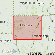
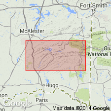
- Areal extent
- AAPG geologic province:
-
- Arkoma basin
- Ouachita folded belt
Summary:
Placed Strington shale opposite Womble schistose sandstone, Blakely sandstone, Mazarn shale, and St. Peter ("Burgen") sandstone.
Source: US geologic names lexicon (USGS Bull. 896, p. 2076-2077).
- Usage in publication:
-
- Stringtown shale*
- Modifications:
-
- Age modified
- AAPG geologic province:
-
- Arkoma basin
- Ouachita folded belt
Summary:
Stringtown or Womble shale underlies Bigfork chert, overlies Blakely sandstone, and is of basal Black River and upper Chazy (Blount) age.
Source: US geologic names lexicon (USGS Bull. 896, p. 2076-2077).
- Usage in publication:
-
- Stringtown shale*
- Modifications:
-
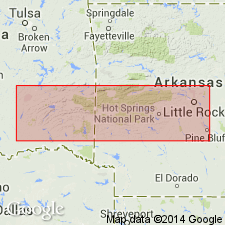
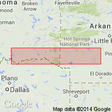
- Areal extent
- AAPG geologic province:
-
- South Oklahoma folded belt
Summary:
Pg. 817. Shales and cherts obtained from the Wall well in Grayson County, [northern Texas], were found to contain Ordovician fossils, and are believed to represent the Big Fork chert and Stringtown shales of the Ouachita section. Lie immediately below Cretaceous rocks.
Source: Geol. Texas (1933, v. 1, p. 130, 131-132).
- Usage in publication:
-
- Stringtown shale
- Modifications:
-
- Biostratigraphic dating
- AAPG geologic province:
-
- Ouachita folded belt
Summary:
In Oklahoma, upper and middle parts of Stringtown shale are equivalent to basal part Viola limestone, based on graptolites; also correlated with Womble, Normanskill, and Glenkiln shales. Age is Ordovician.
Source: Modified from GNU records (USGS DDS-6; Denver GNULEX).

- Usage in publication:
-
- Stringtown shale†
- Modifications:
-
- Abandoned
- AAPG geologic province:
-
- Arkoma basin
- Ouachita folded belt
Summary:
†Stringtown shale. The USGS has now replaced this name with Womble shale, which affords a better type locality and which contains in its upper part beds similar, lithologically and faunally, to Stringtown shale. (See paper by T.A. Hendricks, M.M. Knechtel, and Josiah Bridge, in AAPG Bull., v. 21, no. 1, 1937, p. 1-29.)
Source: US geologic names lexicon (USGS Bull. 896, p. 2076-2077).
For more information, please contact Nancy Stamm, Geologic Names Committee Secretary.
Asterisk (*) indicates published by U.S. Geological Survey authors.
"No current usage" (†) implies that a name has been abandoned or has fallen into disuse. Former usage and, if known, replacement name given in parentheses ( ).
Slash (/) indicates name conflicts with nomenclatural guidelines (CSN, 1933; ACSN, 1961, 1970; NACSN, 1983, 2005, 2021). May be explained within brackets ([ ]).