The National Geologic Map Database is migrating to a new infrastructure. We apologize for any service disruptions during this process.
|
|---|


- Usage in publication:
-
- Stribling formation*
- Modifications:
-
- First used
- Dominant lithology:
-
- Limestone
- AAPG geologic province:
-
- Llano uplift
Summary:
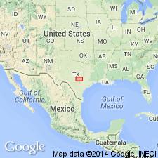
First published general description. Name assigned in eastern Blanco Co., TX on the Llano uplift. Named for the Stribling Ranch. Type locality is 5 mi east of Johnson City at foot of a bluff on south bank of Pedernales River in area called Honeycut Bend in the Peter Jackson survey. Geologic map. Mapped as a thin band in 3 localities. Diagram and measured section of type "section". Overlies Ordovician Ellenburger group. Underlies Mississippian chert breccia which underlies Chappel at type where it is 133 ft thick of limestone with lenses and fillings of chert. The limestone may be arenaceous or argillaceous, microgranular, yellow, gray to beige. Fossils abundant in some beds. Is very distinct from light gray medium-to thick-bedded Ellenburger. Devonian age.
Source: GNU records (USGS DDS-6; Denver GNULEX).
For more information, please contact Nancy Stamm, Geologic Names Committee Secretary.
Asterisk (*) indicates published by U.S. Geological Survey authors.
"No current usage" (†) implies that a name has been abandoned or has fallen into disuse. Former usage and, if known, replacement name given in parentheses ( ).
Slash (/) indicates name conflicts with nomenclatural guidelines (CSN, 1933; ACSN, 1961, 1970; NACSN, 1983, 2005, 2021). May be explained within brackets ([ ]).