

- Usage in publication:
-
- Straven conglomerate member*
- Modifications:
-
- Original reference
- Dominant lithology:
-
- Conglomerate
- AAPG geologic province:
-
- Appalachian basin
Summary:
Straven conglomerate member of Pottsville formation. A very coarse conglomerate, 40 feet thick, in upper part of Pottsville formation in Cahaba coal field. Rests on Thompson coal. Age is Pennsylvanian.
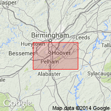
Named from Straven, Montevallo quadrangle, Shelby Co., central AL.
Source: US geologic names lexicon (USGS Bull. 896, p. 2075).
- Usage in publication:
-
- Straven conglomerate member
- Modifications:
-
- Overview
- AAPG geologic province:
-
- Appalachian basin
Summary:
Pg. 29-30. Straven conglomerate member of Pottsville formation. Mentioned in discussion of age relation of subdivisions of Pottsville formation. In the Cahaba basin is the basal bed of a conglomeratic sequence 2,000 feet thick (citing Butts, USGS Geol. Atlas of the US, Bessemer-Vandiver folio, no. 221, p. 14, 1927). Lies immediately above Thompson coal bed, which Butts [1926] includes with "middle Pottsville" strata. Beds of "upper Pottsville" age occur a short distance above Straven conglomerate member.
[Misprint (US geologic names lexicon, USGS Bull. 1200, p. 3749): ... Straven conglomerate, thickness about 2,000 feet ... should be ... Straven conglomerate is the basal bed of a conglomeratic sequence 2,000 feet thick ...]
Source: Publication; US geologic names lexicon (USGS Bull. 1200, p. 3749).
- Usage in publication:
-
- Straven Conglomerate Member
- Modifications:
-
- Overview
- AAPG geologic province:
-
- Appalachian basin
Summary:
The upper 600 m of the Pottsville Formation consists mainly of coarse conglomerate, conglomeratic sandstone, shale, and coal. The basal conglomerate of this interval is the 9- to 30-m-thick Straven Conglomerate Member. It lies between the lower and upper Thompson coals. The base of the Straven is a reddish-brown to gray, clast-supported conglomerate with poorly sorted, subangular to well-rounded clasts of chert, quartz, quartzite, sandstones, volcanic rocks, granitic rocks, and clay. Base is sharp and erosional. The Straven grades upward into a pebbly sandstone or matrix-supported conglomerate. The coarsest clasts are found near Helena and Brantleyville. Clast composition varies. Clasts may be of black chert, white chert, quartz, quartzite, gray sandstone, quartz pebble conglomerate, green sandstone, gray arkosic sandstone, quartz mica schist, granitic gneiss, rhyolite porphyries, basalts, granodiorite, quartz monzodiorite, or clay. Sandstone and chert clasts are the most common. The various facies of the Straven Conglomerate can be compared to the classic Donjek model of the braided river. The Straven braided stream system consisted mainly of longitudinal bars and shallow channels, characterized by frequent flooding. Paleocurrent was probably from the southeast.
Source: GNU records (USGS DDS-6; Reston GNULEX).
For more information, please contact Nancy Stamm, Geologic Names Committee Secretary.
Asterisk (*) indicates published by U.S. Geological Survey authors.
"No current usage" (†) implies that a name has been abandoned or has fallen into disuse. Former usage and, if known, replacement name given in parentheses ( ).
Slash (/) indicates name conflicts with nomenclatural guidelines (CSN, 1933; ACSN, 1961, 1970; NACSN, 1983, 2005, 2021). May be explained within brackets ([ ]).