- Usage in publication:
-
- Stratford formation
- Modifications:
-
- Named
- Dominant lithology:
-
- Limestone
- Shale
- Sandstone
- AAPG geologic province:
-
- Arkoma basin
- South Oklahoma folded belt
Summary:
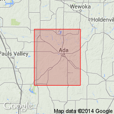
Named for town of Stratford, western part of Stonewall quad, Garvin Co, OK. No type locality designated. Is middle of three formations of Pontotoc terrane [Group], newly named in this report. Overlies Vanoss formation (new) of Pontotoc and underlies Konawa formation (new) of Pontotoc. Is about 400 ft thick in Stonewall quad; extends from Garvin Co, S. Oklahoma folded belt province east into Pontotoc Co, Arkoma basin, and south into Murray Co, S. Oklahoma folded belt province. Includes Hart limestone member (new) at base, typically developed in western part of T3N, R4E, Pontotoc Co, which consists of a series of alternating limestones, shales, and sandstones. In vicinity of Hart the limestone beds are very prominent, but to north and south some of them thin out while others grade into shale. Northeast of Stratford, Hart is covered by a large area of Gertie sand. As a rule, arkosic material is not abundant in the Hart limestone beds, but it is always present, and constitutes a large portion of the rock in a few beds. Outcrops of Hart limestones that have not been long exposed to weathering are generally rather soft and grayish white in color. On weathering the beds become very hard, developing a conchoidal fracture and attaining a much lighter color. Above Hart is an undetermined thickness largely composed of dark-colored shales, with a few sandstones, some very arkosic. Is Permian age. Generalized columnar section, geologic map.
Source: GNU records (USGS DDS-6; Denver GNULEX).
For more information, please contact Nancy Stamm, Geologic Names Committee Secretary.
Asterisk (*) indicates published by U.S. Geological Survey authors.
"No current usage" (†) implies that a name has been abandoned or has fallen into disuse. Former usage and, if known, replacement name given in parentheses ( ).
Slash (/) indicates name conflicts with nomenclatural guidelines (CSN, 1933; ACSN, 1961, 1970; NACSN, 1983, 2005, 2021). May be explained within brackets ([ ]).

