- Usage in publication:
-
- Stonewall Formation*
- Modifications:
-
- Named
- Dominant lithology:
-
- Gneiss
- Amphibolite
- Schist
- AAPG geologic province:
-
- Piedmont-Blue Ridge province
Summary:
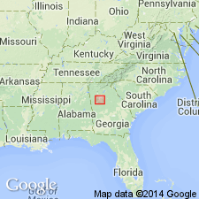
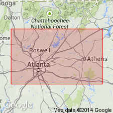
The Stonewall Formation of the Atlanta Group, here named in the Newnan-Tucker synform near Atlanta, GA, consists of medium-grained biotite gneiss and fine-grained hornblende-plagioclase amphibolite interlayered with sillimanite-biotite schist. Sharply and conformably overlies the Wahoo Creek Formation, and sharply and conformably underlies the Clarkston Formation. Thickness is 1,000 to 1,500 m. Age is Late Proterozoic and (or) early Paleozoic.
Source: GNU records (USGS DDS-6; Reston GNULEX).

- Usage in publication:
-
- Stonewall Formation*
- Modifications:
-
- Revised
- AAPG geologic province:
-
- Piedmont-Blue Ridge province
Summary:
The Stonewall Formation is removed from the Atlanta Group which is here abandoned. It consists of intercalated biotite gneiss and amphibolite, and lesser amounts of schist, and includes the lower Stonewall slice of the Atlanta thrust sheet on the northwest limb and near the southern end of the Newnan-Tucker synform in Georgia. Age is Late Proterozoic to Early Ordovician(?).
Source: GNU records (USGS DDS-6; Reston GNULEX).

- Usage in publication:
-
- Stonewall Gneiss*
- Modifications:
-
- Revised
- Redefined
- Age modified
- Overview
- AAPG geologic province:
-
- Piedmont-Blue Ridge province
Summary:
In the allochthonous assemblage, Stonewall Formation revised as Stonewall Gneiss because detailed field mapping showed that more than 98 percent of the unit is gneiss laced with pegmatite; whereas amphibolite and ultramafic rocks are an important part of the unit, they are rare or absent. Stonewall Gneiss is also known by its field term "orange gneiss." Consists of gray to dark-gray, medium- to coarse-grained, commonly schistose, generally pegmatitic (biotite-muscovite-quartz-potassium-feldspar pegmatites), biotite-rich gneiss with generally rare but locally fairly common layers, lenses, and pods of hornblende-plagioclase amphibolite; commonly contains small pods and lenses of altered ultramafic rocks, now mostly soapstone and serpentinites, but originally probably pyroxenites, dunites, and peridotites; also locally contains small red garnets. Weathers to uniform, slightly micaceous, dark-red saprolite and clayey dark-red soil. Includes an unnamed schist and gneiss member consisting of (+/-garnet)-biotite-muscovite feldspar-quartz schist with lesser amounts of typical Stonewall Gneiss; includes pegmatite dikes and sills similar to undivided Stonewall. Member is typically exposed in Yorkville, GA, 7.5-min quad in roadcuts along unpaved, unnamed road running southwest from near eastern edge of quad toward McPherson for about 1830 km from where that road leaves an unnamed southeast-running road. Powers Ferry Formation is removed from Sandy Springs Group and is reassigned as Powers Ferry Member of Stonewall because detailed mapping has shown it to be a facies of the Stonewall and not part of the Sandy Springs. Rocks previously mapped as Kalves Creek Formation (a unit similar but not identical to Ola Formation) are actually schistose Stonewall Gneiss; Kalves Creek is reduced in rank to Kalves Creek Member of Stonewall. Rocks previously mapped as Clairmont Formation are now considered to be a facies of Stonewall. Clairmont paleosome is tectonic melange probably composed chiefly of Stonewall and locally the Clairmont is in gradational contact with undivided Stonewall rocks. Clairmont is therefore reduced in rank to Clairmont Member of Stonewall. Detailed mapping of Ola Formation has shown that most of its schist is actually schistose biotite gneiss of the Stonewall and the Ola is abandoned herein. Detailed mapping also shows that gneiss previously mapped as Apalachee Formation in its type area is actually Stonewall and the Apalachee is abandoned herein. Detailed mapping also shows that rocks previously called Big Cotton Indian Formation in area north of Soapstone Ridge actually belong to the unnamed mixed unit of the allochthonous assemblage, which includes manganiferous quartzite (gondites). Around Soapstone Ridge (around sheath fold), it is actually Stonewall Gneiss. South of Soapstone Ridge (which includes type locality and section of Big Cotton Indian) it is actually Stonewall Gneiss intruded by light-colored metagranite (the "granite gneisses" in Big Cotton Indian in original description of Higgins and Atkins, 1981). Big Cotton Indian Formation is therefore abandoned and its rocks assigned to either the unnamed mixed unit of the allochthonous assemblage or Stonewall Gneiss. Stonewall appears to be in stratigraphic contact with overlying Ropes Creek Metabasalt and in fault contact with underlying Paulding Volcanic-Plutonic Complex. Age of Stonewall Gneiss of the allochthonous assemblage is changed to Late Proterozoic(?) to Middle Ordovician(?) based on a more conservative theory that the allochthonous rocks are 1) probably not older than Late Proterozoic because they are not part of Middle Proterozoic (Grenvillian) basement and 2) they could be as young, but not younger than, the time marking the beginning of closure of the ocean they originated in, as set by the slope reversal marked by deposition of Middle Ordovician Rockmart Slate upon unconformity at top of Upper Cambrian to Middle(?) Ordovician Knox Group and Middle Ordovician Lenoir Limestone. Report includes geologic map and correlation chart.
Source: GNU records (USGS DDS-6; Reston GNULEX).
For more information, please contact Nancy Stamm, Geologic Names Committee Secretary.
Asterisk (*) indicates published by U.S. Geological Survey authors.
"No current usage" (†) implies that a name has been abandoned or has fallen into disuse. Former usage and, if known, replacement name given in parentheses ( ).
Slash (/) indicates name conflicts with nomenclatural guidelines (CSN, 1933; ACSN, 1961, 1970; NACSN, 1983, 2005, 2021). May be explained within brackets ([ ]).

