

- Usage in publication:
-
- Stonehouse Canyon Member*
- Modifications:
-
- Original reference
- Dominant lithology:
-
- Conglomerate
- Shale
- AAPG geologic province:
-
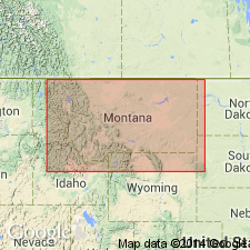
- Central Montana uplift
- Powder River basin
- Williston basin
Summary:
Pg. B9, B12-B14, pls. Stonehouse Canyon Member of Tyler Formation of Amsden Group. Tyler Formation divided into two members based largely on color and partly on lithology. Lower member, Stonehouse Canyon, includes those strata composed predominantly of dark-gray rocks. These are beds 18 to 26 of Easton's (1962, USGS Prof. Paper 348) section at Alaska Bench which are here designated as type section. Thickness about 288 feet. Conglomeratic sandstone, less than half a foot thick at base of Stonehouse Canyon Member in Stonehouse Canyon, thickens gradually westward and rests on successively older limestone and shale beds of Heath Formation. In Stonehouse Canyon this conglomerate is 322 feet above base of the Heath; but about 2-1/3 miles west of State Road 25, the conglomerate is 10 feet thick and lies about 60 feet above base of Heath. Fossiliferous. Age is Early Pennsylvanian (Morrowan).
Type section: along prominent cliff forming west end of Alaska Bench from NE/4 SW/4 sec. 25, T. 13 N., R. 19 E., to the SW/4 sec. 36, T. 13 N., R. 19 E., and thence continued to the NE/4 sec. 1, T. 12 N., R. 19 E., Fergus Co., central MT (=beds 18 to 26 of Easton, 1962). Named from Stonehouse Canyon, in secs. 29, 31, and 32, T. 11 N., R. 21 E., Golden Valley Co., central MT.
Reference section: Stonehouse Canyon, in secs. 29, 31, and 32, T. 11 N., R. 21 E., Golden Valley Co., central MT.
Source: US geologic names lexicon (USGS Bull. 1350, p. 726); supplemental information from GNU records (USGS DDS-6; Denver GNULEX).
- Usage in publication:
-
- Stonehouse Canyon Member*
- Modifications:
-
- Revised
- Dominant lithology:
-
- Mudstone
- Sandstone
- AAPG geologic province:
-
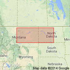
- Central Montana uplift
- Williston basin
Summary:
Pg. 180 (fig. 2), 183 (fig. 4), 185, 186-187. Stonehouse Canyon Member (restricted) of Tyler Formation of Amsden Group. Excludes the argillaceous limestone and calcareous mudstone beds in upper part herein named Bear Gulch Member of Tyler. Consists chiefly of dark-gray mudstone and yellowish- and light-gray sandstone. Thin beds of coal occur locally. Thickness up to 400 feet. Underlies and intertongues with Bear Gulch and Cameron Creek Members of Tyler. Overlies Heath Formation of Big Snowy Group. Fossiliferous. Age is Early Pennsylvanian (Morrowan).
Recognized in Big Snowy Mountains, Fergus County, central Montana, and in western North Dakota.
Source: Publication.
For more information, please contact Nancy Stamm, Geologic Names Committee Secretary.
Asterisk (*) indicates published by U.S. Geological Survey authors.
"No current usage" (†) implies that a name has been abandoned or has fallen into disuse. Former usage and, if known, replacement name given in parentheses ( ).
Slash (/) indicates name conflicts with nomenclatural guidelines (CSN, 1933; ACSN, 1961, 1970; NACSN, 1983, 2005, 2021). May be explained within brackets ([ ]).