- Usage in publication:
-
- Stolle Road Bed
- Modifications:
-
- Named
- Dominant lithology:
-
- Shale
- AAPG geologic province:
-
- Appalachian basin
Summary:
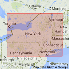
Peculiar undulatory concretionary horizon above the Mt. Vernon Bed is here referred to as the Stolle Road Bed. The Mt. Vernon lies at the base of the Darien Center Submember of the Wanakah Shale Member of the Ludlowville Formation. "Large ellipsoidal concretions of this bed mark a wavy surface, which rises over irregularly-spaced lenticular bodies of nearly barren blue-gray shale, but between them becomes welded to the top of the Mt. Vernon." The Stolle Road Bed is characterized by dense accumulations of tiny brachiopods and styliolinids, orthoconic nautiloids, and palaeozygopleurid gastropods. Unusual feature is occurrence of 10-cm-wide branching concretionary bodies up to a meter in length. As bed is traced up sides of the barren shale lenses, it thins and loses many of its faunal components, becoming increasingly pyrite rich. Above the Stolle Road Bed, the first traceable shelly horizon is a widespread bed here named the Girdle Road Bed. Age of the Wanakah Shale Member and all its components is Middle Devonian.
["Submember" not recognized as a formal stratigraphic rank term (CSN, 1933; ACSN, 1961, 1970; NACSN, 1983, 2005). Considered informal until formally published. The rank or lithologic term should not be capitalized.]
Source: GNU records (USGS DDS-6; Reston GNULEX).
For more information, please contact Nancy Stamm, Geologic Names Committee Secretary.
Asterisk (*) indicates published by U.S. Geological Survey authors.
"No current usage" (†) implies that a name has been abandoned or has fallen into disuse. Former usage and, if known, replacement name given in parentheses ( ).
Slash (/) indicates name conflicts with nomenclatural guidelines (CSN, 1933; ACSN, 1961, 1970; NACSN, 1983, 2005, 2021). May be explained within brackets ([ ]).

