

- Usage in publication:
-
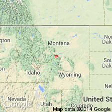
- Stillwater complex
- Modifications:
-
- First used
- Dominant lithology:
-
- Gabbro
- Pyroxenite
- Norite
- Peridotite
- AAPG geologic province:
-
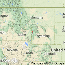
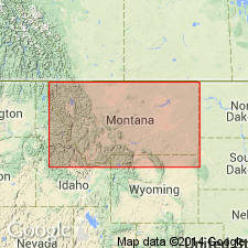
- Northern Rocky Mountain region
Summary:
First published use [other than abstracts] as a name for a banded igneous complex that is exposed for 30 mi along northeast margin of Beartooth Range. Named for exposures in canyon of Stillwater River, Stillwater Co, MT in the Northern Rocky Mountain region. Consists of norite, gabbro, pyroxenite, peridotite and related rocks that are in contact with Paleozoic sedimentary rocks on the north and with pre-Cambrian granite and metamorphosed sediments on the south. Igneous complex thought to be a sheet or lopolith intrusive into pre-Cambrian sedimentary rocks and in turn intruded by pre-Cambrian granite. Top eroded before deposition of Middle Cambrian rocks on it. Was tilted in the Laramide. Divided into four zones: Basal Zone 0-200 ft thick; Ultramafic Zone 1850 to 3300 ft thick; Banded Zone 3700 to 7350 ft thick; and Upper Zone 800 to 6000 ft thick. Is more than 16,000 ft thick on the East Boulder Plateau. Origin of rock types thought to have resulted from differentiation in a lopolithic chamber of a magma with the composition of the basal norite.
Source: GNU records (USGS DDS-6; Denver GNULEX).
- Usage in publication:
-
- Stillwater complex*
- Modifications:
-
- Overview
- Dominant lithology:
-
- Anorthosite
- Gabbro
- Norite
- AAPG geologic province:
-
- Northern Rocky Mountain region
Summary:
First detailed published description. Applied as a name to a belt of layered ultramafic igneous rocks composed chiefly of olivine and pyroxene. Divided into: a basal zone composed of diabasic norite, 0-200 ft thick; an ultramafic zone composed of olivine and pyroxene in various proportions, bronzitite, harzburgite, and dunite, 1,850 to 4,000 ft thick; a banded zone composed of gray or brown norite, bands of white or gray anorthosite and olivine gabbro, 3,700 to 7,350 ft thick; and an upper zone composed of gray, white, and spotted anorthosite, norite, and gabbro, 800 to 6,000 ft thick. Exposed in a belt 1-5 mi wide and 30 mi long on northern margin of Beartooth Mountains, in Stillwater and Sweet Grass Cos, and in Park Co in Northern Rocky Mountain region, MT. Is younger than some metamorphosed sedimentary rocks of pre-Cambrian age on west side of Stillwater Canyon. Is cut by granite of pre-Cambrian age. Is assigned to pre-Cambrian. Cross sections; nomenclature chart; geologic map.
Source: GNU records (USGS DDS-6; Denver GNULEX).
- Usage in publication:
-
- Stillwater complex*
- Modifications:
-
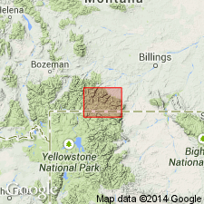
- Areal extent
- AAPG geologic province:
-
- Northern Rocky Mountain region
Summary:
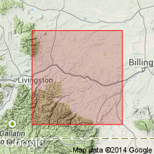
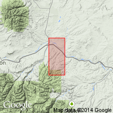
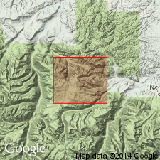
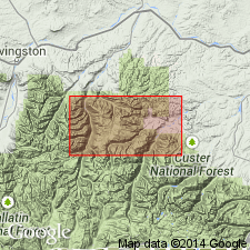
Three zones mapped: the basal zone; ultramafic zone; and banded zone [informal zones not capitalized]. Overlies Precambrian basement complex. Is older than Precambrian diabase and gabbro. Areal extent of Stillwater shown as extending from Stillwater Co (T6S, R16E) into Sweet Grass Co northwest for about 28 mi to Park Co (T4N, R12E) in the Northern Rocky Mountain region (fig 17, p 101).
Source: GNU records (USGS DDS-6; Denver GNULEX).

- Usage in publication:
-
- Stillwater complex
- Modifications:
-
- Overview
- AAPG geologic province:
-
- Northern Rocky Mountain region
Summary:
Is a lopolith, a huge concordant sheet of which the lower 16,000 ft are exposed. Roof and upper portion are hidden beneath Paleozoic rocks. Divided into six zones: Border Zone 400 ft thick; Ultramafic Zone 2,500 ft thick; Norite Zone 2,740 ft thick; Lower Gabbro Zone 2,210 ft thick; Anorthosite Zone (which has three Anorthosite Subzones) 6,210 ft thick; and Upper Gabbro Zone 2,130 ft thick. [Informal divisions capitalized throughout]. Good summary report. Comparisons made with other large basaltic intrusions in the world. Is mapped in Northern Rocky Mountain region. Assigned a Precambrian age.
Source: GNU records (USGS DDS-6; Denver GNULEX).
- Usage in publication:
-
- Stillwater complex*
- Modifications:
-
- Overview
- AAPG geologic province:
-
- Northern Rocky Mountain region
Summary:
Is a stratiform sheet in the Northern Rocky Mountain region about 18,000 ft thick of Precambrian age. Consists of four zones: 1) Basal zone, 200 ft thick (medium-grained noritic rocks); 2) Ultramafic zone, 4,000 to 6,000 ft thick (succession of layers of bronzitite, granular harzburgite, poikilitic harzburgite, and chromitite); 3) Banded; and 4) Upper zones, 14,000 ft thick (layers of norite, anorthosite, troctolite, and gabbro). ("Informal terms...capitalized for clarity..." according to authors). Layers exhibit igneous lamination and rhythmic layering. Rhythmic layers range from a fraction of an inch to hundreds of feet.
Source: GNU records (USGS DDS-6; Denver GNULEX).
- Usage in publication:
-
- Stillwater complex
- Modifications:
-
- Age modified
- Geochronologic dating
- AAPG geologic province:
-
- Northern Rocky Mountain region
Summary:
U-Pb zircon analyses from Stillwater complex basal zone and associated rocks used to document absolute age of emplacement of Stillwater igneous complex in Sweet Grass and Stillwater Cos, MT (Northern Rocky Mountain region). Conclusions: 1) Stillwater igneous complex emplaced about 2,750 m.y. ago; 2) there is less than 60 m.y. difference between intrusion of Stillwater complex and emplacement of siliceous igneous rocks (e.g. Mouat quartz monzonite) at southeastern end of complex; 3) Stillwater complex intruded sediments or metasediments containing approximately 3,140 m.y. old (or older) zircons; 4) Stillwater complex contact metamorphism did not reset U-Pb clock in zircons from exposed hornfels, although hornfels zircons appear to have lost from about 10-40 percent of their lead due to intrusion of the complex; 5) discordant zircon data appear best explained with an episodic lead loss mechanism (lead having been lost about 2,750 and 100 m.y. ago); 6) possibilities of uranium gain at these times, or some continuous diffusion lead loss, or both, may not be excluded; 7) U-Pb apatite analyses suggest apatite in vicinity of Stillwater complex lost lead or gained uranium about 1,600 m.y. ago during an event that did not significantly influence the zircon ages; 8) limited plagioclase data showed that the lead isotopic compositions of the Stillwater complex anorthosite have been disturbed since the complex was emplaced.
Source: GNU records (USGS DDS-6; Denver GNULEX).
- Usage in publication:
-
- Stillwater Complex
- Modifications:
-
- Age modified
Summary:
Has an approximate 1,600 m.y. (approximately) date, placing it at the Precambrian X-Y boundary.
Source: GNU records (USGS DDS-6; Denver GNULEX).
- Usage in publication:
-
- Stillwater Complex*
- Modifications:
-
- Age modified
- AAPG geologic province:
-
- Northern Rocky Mountain region
Summary:
Lies on north side of West Fork Stillwater River east of Crescent Creek, in Stillwater and Sweet Grass Cos, and in Park Co in Northern Rocky Mountain region. Is represented by the basal zone, and the peridotite (lower) and bronzitite (upper) members of the ultramafic zone [informal zones not capitalized]. Intruded rocks at least 3,140 m.y. and is intruded by quartz monzonite dated at 2,750 m.y. May be somewhat older than 2,750 [or Precambrian W].
Source: GNU records (USGS DDS-6; Denver GNULEX).
- Usage in publication:
-
- Stillwater Complex
- Modifications:
-
- Overview
- AAPG geologic province:
-
- Northern Rocky Mountain region
Summary:
In Stillwater Complex, available isotopic data suggest two models: 1) crystallization of Stillwater Complex 2,700 Ma from magmas derived from upper-mantle source that exhibited a history of Rb/Sr, Nd/Sm, U/Pb and Hf/Lu enrichment; or 2) crystallization 2,700 Ma from magmas derived from an undepleted or "chrondritic" upper-mantle source, or from a depleted source, but contaminated with older continental crust enriched in incompatible trace elements (Rb, U, Th and LREE). Neither model accepted as preferred. 2,700 Ma is Late Archean. Stillwater occurs in Sweet Grass Co, MT, and in Park Co, MT in Northern Rocky Mountain region.
Source: GNU records (USGS DDS-6; Denver GNULEX).
For more information, please contact Nancy Stamm, Geologic Names Committee Secretary.
Asterisk (*) indicates published by U.S. Geological Survey authors.
"No current usage" (†) implies that a name has been abandoned or has fallen into disuse. Former usage and, if known, replacement name given in parentheses ( ).
Slash (/) indicates name conflicts with nomenclatural guidelines (CSN, 1933; ACSN, 1961, 1970; NACSN, 1983, 2005, 2021). May be explained within brackets ([ ]).