The National Geologic Map Database is migrating to a new infrastructure. We apologize for any service disruptions during this process.
|
|---|


- Usage in publication:
-
- Stetson Mountain Formation
- Modifications:
-
- First used
- Dominant lithology:
-
- Volcanics
- AAPG geologic province:
-
- New England province
Summary:
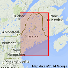
Kossuth Group [new name] subdivided in this report into (ascending) Bowers Mountain and Stetson Mountain Formations [new names]. Stetson Mountain originally mapped as "rocks of Snow Mountain" by Larrabee and others (1965). Forms distinctive outcrop band traceable from Pokiok pluton just east of Danforth through Danforth, Scraggle Lake, and Springfield quads, into the Bottle Lake pluton. Three subdivisions of the Stetson Mountain recognized in the Danforth area are here [informally] named the Tolman Hill, Ironstone, and Public Lot Ridge members. Lower and upper members are composed almost wholly of felsic volcanic rocks. Middle member is distinctive and contains several unique rock types including magnetite-rich and hematite-rich layers and thinly-bedded manganiferous siltstone and pelite and minor ashflow tuffs. Stetson Mountain unconformably underlies the Mill Priviledge Brook Formation of the Prentiss Group [new informal names]. Graptolites from the Tolman Hill member indicate a Caradocian age.
Source: GNU records (USGS DDS-6; Reston GNULEX).
- Usage in publication:
-
- Stetson Mountain Formation
- Modifications:
-
- Overview
- AAPG geologic province:
-
- New England province
Summary:
"Rocks of the Miramichi belt are separated by an unconformity into two packages--the Baskahegan Lake Formation and the Kossuth Group." The Baskahegan Lake is more complexly deformed than the formations of the overlying Kossuth. A middle Caradocian age is indicated by graptolites for the Stetson Mountain Formation at the top of the Kossuth, while an Early Ordovician age (Arenigian(?)-Llandeilian) age is inferred for the lower part of the Bowers Mountain Formation. Coeval strata in the St. Croix belt--the Kendall Mountain Formation--is not at all similar lithologically. [Unit name is italicized throughout the report as authors consider it informal at this time. They state that it is being formally proposed but do not indicate a reference for such a proposal. Reader is referred to Ludman (1990), an Open-File report, for a complete description of the unit.]
Source: GNU records (USGS DDS-6; Reston GNULEX).
For more information, please contact Nancy Stamm, Geologic Names Committee Secretary.
Asterisk (*) indicates published by U.S. Geological Survey authors.
"No current usage" (†) implies that a name has been abandoned or has fallen into disuse. Former usage and, if known, replacement name given in parentheses ( ).
Slash (/) indicates name conflicts with nomenclatural guidelines (CSN, 1933; ACSN, 1961, 1970; NACSN, 1983, 2005, 2021). May be explained within brackets ([ ]).