- Usage in publication:
-
- Sterling Till Member
- Modifications:
-
- Named
- Dominant lithology:
-
- Till
- AAPG geologic province:
-
- Wisconsin arch
Summary:
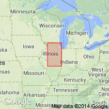
Informally named the Sterling till for Sterling, Whiteside Co, IL (Frye and others, 1969, p. 25) with type section the Emerson Quarry Section (Frye and others, 1969, p. 34) 2 mi west of Sterling, SE NW SE sec 13, T21N, R6E. Is formally named the uppermost till member of Glasford Formation (new) in region north of Green River Lobe. Is similar in clay mineral composition to Radnor Till Member (new), which occupies same stratigraphic position south of Green River Lobe. Both members have extremely high illite content (81 and 77 percent of clay, respectively, table 2). Sterling is as thick as 40 ft near Sterling, but is generally thinner. Geographic extent shown in fig 6 (southern part of Wisconsin arch). Typical composition shown in table 2. Upper boundary is top of Sangamon Soil; locally, the base of accretion-gley of Berry Clay Member (new). Is overlain locally by Winnebago Formation, Robein Silt (new), Wedron Formation, or Peoria Loess. Overlies Ogle Till Member or older units. Is assigned to the Jubileean Substage of the Illinoian Stage.
Source: GNU records (USGS DDS-6; Denver GNULEX).
For more information, please contact Nancy Stamm, Geologic Names Committee Secretary.
Asterisk (*) indicates published by U.S. Geological Survey authors.
"No current usage" (†) implies that a name has been abandoned or has fallen into disuse. Former usage and, if known, replacement name given in parentheses ( ).
Slash (/) indicates name conflicts with nomenclatural guidelines (CSN, 1933; ACSN, 1961, 1970; NACSN, 1983, 2005, 2021). May be explained within brackets ([ ]).

