- Usage in publication:
-
- Starvation Draw member
- Modifications:
-
- Named
- Dominant lithology:
-
- Conglomerate
- Sandstone
- Mudstone
- Shale
- AAPG geologic province:
-
- Basin-and-Range province
Summary:
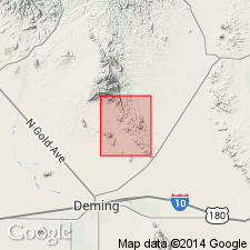
Named as an informal basal unit of Rubio Peak Formation in Massacre quad, Luna Co, NM, Basin-and-Range province (probably for Starvation Draw). The southern end of Cooke's Range is composed mostly of Rubio Peak Formation, forming a wide band covering about 1/4 of quad. No type locality designated, but partial sections measured: 1) on gullied steep slopes in northwest corner of quad, and 2) on west slope of hill near southeast corner sec 32, T21S, R8W. Thickness to about 500 ft. Composed of interbedded pebble to boulder conglomerates, red sandstones, mudstones, and shales; clasts in lower conglomerates mostly from Precambrian, Paleozoic, and Cretaceous rocks; mostly volcanic rock clasts in upper beds. The Precambrian rocks are similar to Precambrian exposed south of Fluorite Ridge or in northern Florida Mountains. Darton (1916) mapped this unit as "Tertiary agglomerate and associated rocks". Intruded by a dike dated at 37.6 +/-2.0 m.y. Starvation Draw is Eocene; this does not exclude possibility that some basal beds may be as old as Paleocene. May be correlative to part of Lebo Formation in Florida Mountains and to part of Love Ranch Formation in southern San Andres Mountains. Is younger than Colorado Formation; is older than the rest of Rubio Peak Formation (oldest to youngest): a) tuff breccias and conglomerates, b) intrusives, c) flows, and d) undifferentiated flows and intrusives. Thickness to about 500 ft. Geologic map.
Source: GNU records (USGS DDS-6; Denver GNULEX).
For more information, please contact Nancy Stamm, Geologic Names Committee Secretary.
Asterisk (*) indicates published by U.S. Geological Survey authors.
"No current usage" (†) implies that a name has been abandoned or has fallen into disuse. Former usage and, if known, replacement name given in parentheses ( ).
Slash (/) indicates name conflicts with nomenclatural guidelines (CSN, 1933; ACSN, 1961, 1970; NACSN, 1983, 2005, 2021). May be explained within brackets ([ ]).

