The National Geologic Map Database is migrating to a new infrastructure. We apologize for any service disruptions during this process.
|
|---|


- Usage in publication:
-
- Starr Flat Member
- Modifications:
-
- Named
- Dominant lithology:
-
- Sandstone
- Claystone
- Siltstone
- AAPG geologic province:
-
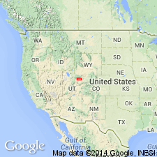
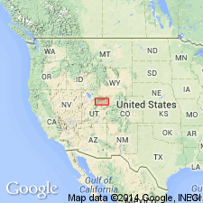
- Uinta basin
Summary:
Named as upper member of Duchesne River Formation for exposures near John Starr Flat, Duchesne Co, UT in the Uinta basin. Type section extends from center sec 22, R1N, R2W on well exposed slope, south of John Starr Flat northwest to prominent ridge at boundary of secs 34 and 35, T2N, R3W. Preserved only near south margin of Uinta Mountains. Is 799+ ft thick at type where it overlies Lapoint Member (formerly Lapoint horizon) and underlies terrace gravel. Thins northward. Is 124 ft thick in Halfway Hollow. Consists of: 1) red- to yellow-brown, light gray, gray- to yellow-orange, pale red to gray red sandstone that ranges from coarse, medium, fine to very fine grained, thin, thick to very thick bedded, sandy, silty, to clayey, cross-stratified to horizontally stratified, flaggy, blocky, massive, brown-gray, gray-red to olive, sandy to silty; 2) very thin bedded, poorly sorted, platy, laminated, nodular to structureless claystone; and 3) gray red, sandy, poorly sorted, thin-bedded, nodular, structureless siltstone. Sandstone may also be poorly sorted, pebbly, nodular and structureless. No fossils found. Probably extends into Oligocene [age not clearly stated]. Cross sections.
Source: GNU records (USGS DDS-6; Denver GNULEX).
- Usage in publication:
-
- Starr Flat Member*
- Modifications:
-
- Areal extent
- Geochronologic dating
- AAPG geologic province:
-
- Uinta basin
Summary:
Is the upper member of Duchesne River Formation. Much of what is mapped as Starr Flat (geologic map) was included in the Bishop Conglomerate. Overlies Lapoint Member along northern margin of basin. Overlaps Mesozoic, Paleozoic, and Precambrian at margin of Uinta uplift from Duchesne-Uintah Co line west to Rock Creek, Duchesne Co. Ranges from pale-red to gray-red boulder conglomerate, sandstone, and claystone near mountains, and gray sandy claystone near axis of Uinta basin. Rocks on Little Mountain, east part of basin, Uintah Co mapped by some as Bishop Conglomerate are mapped as Starr Flat in this report. Bishop-Starr Flat contact difficult to place, because of lack of significant difference in lithology between them. Oligocene age. Isotopic ages based on zircon range from 34.0 +/-1.7 to 30.0 +/-1.5 Ma. Oligocene age.
Source: GNU records (USGS DDS-6; Denver GNULEX).
For more information, please contact Nancy Stamm, Geologic Names Committee Secretary.
Asterisk (*) indicates published by U.S. Geological Survey authors.
"No current usage" (†) implies that a name has been abandoned or has fallen into disuse. Former usage and, if known, replacement name given in parentheses ( ).
Slash (/) indicates name conflicts with nomenclatural guidelines (CSN, 1933; ACSN, 1961, 1970; NACSN, 1983, 2005, 2021). May be explained within brackets ([ ]).