

- Usage in publication:
-
- Standley shale*
- Modifications:
-
- Original reference
- Dominant lithology:
-
- Shale
- Chert
- Sandstone
- AAPG geologic province:
-
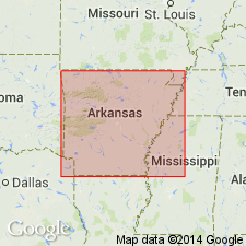
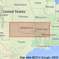
- Ouachita folded belt
Summary:
Standley shale. Upper part bluish and greenish fissile green shales and massive and thin-bedded friable drab sandstones; lower part siliceous and cherty fissile shale. Thickness 6,100 feet. Underlies Jackfork sandstone and overlies Talihini chert.
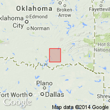
Named from Stanley, Pushmataha Co., OK.
Source: US geologic names lexicon (USGS Bull. 896, p. 2053).
- Usage in publication:
-
- Stanley shale
- Modifications:
-
- Revised
- AAPG geologic province:
-
- Ouachita folded belt
Summary:
Stanley shale. Greenish clay shale, with, locally, black slate near base and greenish quartzitic sandstone, frequently a conglomerate at base. Thickness 6,000 feet. Unconformably overlies Fork Mountain slate, 0 to 125 feet thick. [Stanley shale as used in this report included Hot Springs sandstone of Hot Springs area. This definition of Stanley shale (to exclude †Fork Mountain slate) was also used by Purdue in USGS Bull. 586, 1914.]
Source: US geologic names lexicon (USGS Bull. 896, p. 2053).
- Usage in publication:
-
- Stanley shale*
- Modifications:
-
- Revised
Summary:
Pg. 66. Stanley shale. Some shale at base of Stanley shale has in places been altered to slate, to which name "Fork Mountain slate" has been earlier applied. In Caddo Gap and DeQueen quadrangles, Arkansas and Oklahoma, the Stanley rests unconformably on Arkansas novaculite and underlies Jackfork sandstone.
Source: US geologic names lexicon (USGS Bull. 896, p. 2053).
- Usage in publication:
-
- Stanley shale
- Modifications:
-
- Revised
Summary:
Pg. 125. Stanley shale. Includes Hatton tuff lentil (new).
Source: US geologic names lexicon (USGS Bull. 1200, p. 3706).
- Usage in publication:
-
- Stanley shale
- Modifications:
-
- Age modified
- AAPG geologic province:
-
- Ouachita folded belt
Summary:
[Age of Stanley shale changed to Pennsylvanian (Pottsville).]
Source: US geologic names lexicon (USGS Bull. 896, p. 2053).
- Usage in publication:
-
- Stanley group
- Modifications:
-
- Revised
- AAPG geologic province:
-
- Ouachita folded belt
Summary:
Raised in rank to group--lower of two groups of the Pushmataha series (new) of the Bendian period. Is found in the Ouachita Mountains of OK in the Ouachita tectonic belt province. Exposed only in part of the center of sec 24, T1N, R17E, Pushmataha Co, OK. In all parts of the Ouachita Mountains, is divisible into these units (ascending order): Tenmile Creek formation, Moyers formation, and Chickasaw Creek siliceous shale (all new names). Overlies the Mississippian Caney and underlies Wildhorse Mountain formation (new) of Jackfork group of Pushmataha series of the Bendian period. Correlation chart. Measured sections. Of Carboniferous age.
Source: GNU records (USGS DDS-6; Denver GNULEX).
- Usage in publication:
-
- Stanley shale
- Modifications:
-
- Revised
- AAPG geologic province:
-
- Ouachita folded belt
Summary:
Stanley shale revised--includes newly named Tuskahoma siliceous shale member as third from base of four siliceous shale members (ascending): Basal Ten Mile Creek, Tuskahoma, Middle Ten Mile Creek, and Moyers. Report area is Ouachita Mountains of southeastern OK. Tuskahoma outcrops near the Potato Hills (Pushmataha Co, OK, in Ouachita tectonic belt province). Stanley shale is a sedimentary rock of typical geosynclinal facies. Stanley includes (in the lower part) the Hatton tuff lentil in McCurtain Co, OK and western AR --Hatton is not found in the western part of the OK Ouachita Mountains. Hatton is not one of the siliceous sediments of the Ouachita facies. Stanley shale underlies Pennsylvanian Jackfork sandstone; overlies the Devonian to Mississippian Arkansas novaculite. Is of Mississippian age.
Source: GNU records (USGS DDS-6; Denver GNULEX).
- Usage in publication:
-
- Stanley Group
- Modifications:
-
- Contact revised
- AAPG geologic province:
-
- Arkoma basin
- Ouachita folded belt
Summary:
Upper contact revised in western AR, Ouachita tectonic belt province and Arkoma basin, in that Chickasaw Creek Formation, upper formation of Stanley Group of Mississippian age, underlies newly named Irons Fork Mountain Formation, basal formation of Jackfork Group of Mississippian age. The upper contact is placed at top of a siliceous shale (Chickasaw Creek) with a ridge-forming sandstone (Irons Fork Mountain). Correlation chart; measured sections.
Source: GNU records (USGS DDS-6; Denver GNULEX).
For more information, please contact Nancy Stamm, Geologic Names Committee Secretary.
Asterisk (*) indicates published by U.S. Geological Survey authors.
"No current usage" (†) implies that a name has been abandoned or has fallen into disuse. Former usage and, if known, replacement name given in parentheses ( ).
Slash (/) indicates name conflicts with nomenclatural guidelines (CSN, 1933; ACSN, 1961, 1970; NACSN, 1983, 2005, 2021). May be explained within brackets ([ ]).