- Usage in publication:
-
- Staniukovich shale*
- Modifications:
-
- Named
- Biostratigraphic dating
- Dominant lithology:
-
- Shale
- Sandstone
- AAPG geologic province:
-
- Alaska Peninsula province
- Alaska Southwestern region
Summary:
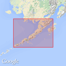
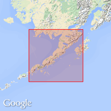
Named for Staniukovich Mountain in Herendeen Bay region, Alaska Peninsula, southwestern AK. Constitutes large part of mountain whose peak is 2400 ft high, overlooking entrance to Port Moller. Also well exposed in north wall of Lawrence Valley. Consists of thin-bedded shales and thin beds of sandstones. Is at least 1000 ft thick. Overlies Naknek formation. Conformably underlies Herendeen limestone (new). Age is Early Cretaceous based on AUCELLA PIOCHII identified by T.W. Stanton.
Source: GNU records (USGS DDS-6; Menlo GNULEX).

- Usage in publication:
-
- Staniukovich Formation*
- Modifications:
-
- Redescribed
- Biostratigraphic dating
- Dominant lithology:
-
- Sandstone
- Siltstone
- AAPG geologic province:
-
- Alaska Peninsula province
- Alaska Southwestern region
Summary:
Staniukovich Shale redescribed as Staniukovich Formation in correlation chart which gives its lithology as arkosic sandstone and siltstone from 0 to 2000 ft thick. Age is late Kimmeridgian to late Tithonian [Late Jurassic] based on fossils collected on Staniukovich Mountain between Herendeen Bay and Port Moller.
Source: GNU records (USGS DDS-6; Menlo GNULEX).

- Usage in publication:
-
- Staniukovich Formation*
- Modifications:
-
- Areal extent
- Revised
- Age modified
- AAPG geologic province:
-
- Alaska Peninsula province
- Alaska Southwestern region
Summary:
Staniukovich Formation. Unit stratigraphically restricted to original definition of Atwood (1911). Strata in Ugashik and Karluk quadrangles (scale 1:250,000) reassigned to Naknek Formation (Indecision Creek Sandstone Member). This reassignment also valid in most of Chignik-Sutwik area; only strata still assigned to unit in this area are along northwest side of mountains bordering Chignik Bay. Age is changed to Early Cretaceous owing to stratigraphic restriction of unit.
Type section clarified: [Staniukovich Mountain area] in sec. 30, T. 50 S., R. 73 W., Port Moller D-2 quadrangle (scale 1:63,360), Alaska Peninsula, AK, where unit is 246 m thick.
Source: Modified from GNU records (USGS DDS-6; Menlo GNULEX).
For more information, please contact Nancy Stamm, Geologic Names Committee Secretary.
Asterisk (*) indicates published by U.S. Geological Survey authors.
"No current usage" (†) implies that a name has been abandoned or has fallen into disuse. Former usage and, if known, replacement name given in parentheses ( ).
Slash (/) indicates name conflicts with nomenclatural guidelines (CSN, 1933; ACSN, 1961, 1970; NACSN, 1983, 2005, 2021). May be explained within brackets ([ ]).

