

- Usage in publication:
-
- Stanaker formation
- Modifications:
-
- Named
- Dominant lithology:
-
- Sandstone
- Siltstone
- AAPG geologic province:
-
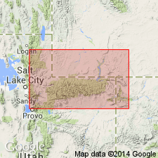
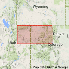
- Uinta basin
Summary:
Named for Stanaker Draw, eastern Uintah Co, UT in the Uinta basin. Type section measured north of Vernal from sec 7, T3S, R22E northward to a gorge tributary to gorge of Brush Creek near northwest corner of sec 32, T2S, R22E and west of Vernal-Manila Hwy. Is 300 ft thick at type where it is composed of basal quartz grit 60 ft thick named Gartra grit member, and an upper part composed of lavender clay shale, gray, coarse-grained feldspathic quartz grit, red to tan, massive, very fine grained sandstone, and red siltstone. Ranges from 120 ft thick at Vermilion Creek, Uintah Co, to 394 ft thick at the Weber River, Summit Co, Uinta uplift. Recognized from Duchesne River to Skull Creek on south side of the Uintas. Six measured sections described. Overlies Woodside shale; underlies Nugget sandstone in the central Wasatch and western Uintas; Correlated with the Chinle formation. Is probably Late Triassic in age.
Source: GNU records (USGS DDS-6; Denver GNULEX).
- Usage in publication:
-
- Stanaker member*
- Modifications:
-
- Revised
- AAPG geologic province:
-
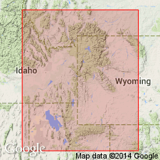
- Wasatch uplift
- Uinta uplift
Summary:
Reduced in stratigraphic rank from formation to upper member of Ankareh formation in the central Wasatch Mountains, UT on the Wasatch uplift and in the western Uinta Mountains on the Uinta uplift. Is restricted stratigraphically to rocks above (rather than including) the Gartra grit member of the Ankareh. [Overlying unit not given.] Cross sections. Correlation chart.
Source: GNU records (USGS DDS-6; Denver GNULEX).
- Usage in publication:
-
- Stanaker Formation
- Modifications:
-
- Not used
Summary:
Not used as a stratigraphic name in this paper. Its Gartra Grit Member modified to Gartra Member and reassigned to Chinle Formation as its basal member on Uinta uplift, Greater Green River basin, and Piceance basin.
Source: GNU records (USGS DDS-6; Denver GNULEX).
- Usage in publication:
-
- Stanaker Member
- Modifications:
-
- Revised
- AAPG geologic province:
-
- Uinta basin
- Uinta uplift
Summary:
Reduced in rank to Stanaker Member and assigned to Chinle Formation as its upper member. Overlies Gartra Member of Chinle. Underlies Nugget [Sandstone]. Stanaker is thus restricted to the redbeds--silty to sandy shale with interbedded siltstone and sandstone--above the Gartra. (The original definition of Stanaker included Gartra.) Forms steep slopes. Varies from 196 to 299 ft thick. Detailed lithology descriptions. Nomenclature chart. Report area covers the eastern Uinta Mountains of UT in the Uinta basin and Uinta uplift.
Source: GNU records (USGS DDS-6; Denver GNULEX).
For more information, please contact Nancy Stamm, Geologic Names Committee Secretary.
Asterisk (*) indicates published by U.S. Geological Survey authors.
"No current usage" (†) implies that a name has been abandoned or has fallen into disuse. Former usage and, if known, replacement name given in parentheses ( ).
Slash (/) indicates name conflicts with nomenclatural guidelines (CSN, 1933; ACSN, 1961, 1970; NACSN, 1983, 2005, 2021). May be explained within brackets ([ ]).