- Usage in publication:
-
- St. Peters formation
- St. Peters soft white sandstone
- Modifications:
-
- Original reference
- Dominant lithology:
-
- Sandstone
- AAPG geologic province:
-
- Sioux uplift
Summary:
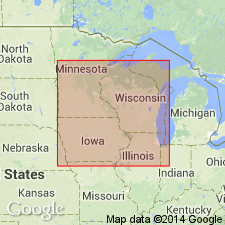
Pg. 169, 170. Soft white sandstone [called St. Peters soft white sandstone on p. 170] near Lake St. Croix, capped with shell limestones such as form upper portions of hills on Wisconsin River near Prairie du Chien and constitute whole of escarpment of St. Peters Falls as well as bluffs on both sides of the Mississippi, from thence to Carvers Cave and St. Pauls, and therefore sometimes alluded to by us under the local name St. Peters formation.
Source: US geologic names lexicon (USGS Bull. 896, p. 1884-1885).
- Usage in publication:
-
- St. Peter sandstone*
- Modifications:
-
- Age modified
- Areal extent
- AAPG geologic province:
-
- Ozark uplift
Summary:
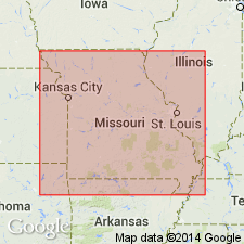
Cambro-Ordovician St. Peter sandstone is equivalent of First or Saccharoidal sandstone of Swallow, Cap au Gres sandstone of Keyes, Pacific sandstone of Ball and Smith, Crystal City sandstone of Winslow, and, in part, Key sandstone of Adams. Marshfield sandstone and Bolivar sandstone of southwestern MO are commonly believed to represent same formation, but Ulrich regards them as lenses within Jefferson City limestone. Ulrich further maintains that true St. Peter sandstone is rarely or never present when Late Devonian or Carboniferous are in contact with Cambro-Ordovician. Crops out in Rolls and Lincoln Cos. and in some counties north of Missouri River to a point nearly half way across the State. Also outcrops in counties just west of Mississippi River and south of St. Louis Co. Occurs under cover all around Ozark Island in MO. Underlies Joachim. Mapped together with Jefferson City which it overlies.
Source: GNU records (USGS DDS-6; Reston GNULEX).

- Usage in publication:
-
- St. Peter sandstone
- Modifications:
-
- Overview
Summary:
In Upper Mississippi Valley region the St. Peter sandstone unconformably overlies Shakopee dolomite and underlies Platteville limestone. In northern Arkansas the name St. Peter sandstone has been misapplied to several sandstone, the upper of which (called "Upper St. Peter" by E.O. Ulrich is now considered to be true St. Peter sandstone. This upper sandstone is overlain by Joachim limestone and is separated from the older Everton limestone (which includes 2 sandstones formerly miscalled St. Peter sandstone) by Jasper limestone. The Lower St. Peter of Ulrich in Arkansas has been named Kings River sandstone member of Everton limestone. (See E.T. McKnight, USGS Bull. 853, 1935.) The beds in northern Arkansas extending from top of upper or true St. Peter sandstone down to top of Powell dolomite were called St. Peter group by C.L. Dake in 1921.
Source: US geologic names lexicon (USGS Bull. 896, p. 1884-1885).
- Usage in publication:
-
- St. Peter sandstone
- Modifications:
-
- Principal reference
- Dominant lithology:
-
- Sandstone
- Shale
- AAPG geologic province:
-
- Sioux uplift
Summary:
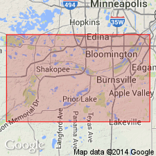
Pg. 352. St. Peter sandstone. Minnesota River was formerly called St. Peter's, and from outcrops near its mouth the St. Peter sandstone was named. Type locality is at Fort Snelling, and type section is that at bluff where Minnesota River joins Mississippi River, in Hennepin County, Minnesota. [On p. 354 is a detailed section of the St. Peter at Fort Snelling, footing 163 feet, resting on Shakopee dolomite and overlain by 8 feet of Glenwood beds, succeeded by 25 feet of Platteville limestone.] Probably eolian. Age is Late Cambrian (St. Croix).
163 ft section remeasured, redescribed [from ?], ascending: (1) white sandstone, 35 feet; (2) siliceous blue shale, 30 feet; (3) white to yellow-brown, medium- to fine-grained, massive sandstone.
Source: US geologic names lexicon (USGS Bull. 896, p. 1884-1885); supplemental information from GNU records (USGS DDS-6; Denver GNULEX).
- Usage in publication:
-
- St. Peter sandstone
- St. Peter series
- Modifications:
-
- Age modified
- Biostratigraphic dating
- AAPG geologic province:
-
- Ozark uplift
- Sioux uplift
Summary:
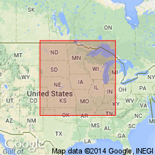
Pg. 1110, 1119, etc. St. Peter sandstone and St. Peter series. In Minnesota and in Ozark region the beds overlying St. Peter series were formerly correlated with Stone River group, but are now known to be Black River in age. In both regions strata of Beekmantown age underlie the St. Peter series. In the east the Black River and Chazyan groups are present, but St. Peter series is absent. In these 3 type outcrop regions there is no evidence to support the generally accepted belief that the St. Peter-Buffalo River sandstone series is pre-Chazyan in age. Work up to present indicates that when studies are completed the St. Peter series will be found in Oklahoma beneath beds of known Black River age, and above beds of known Chazyan age. Writer doubts presence of true St. Peter sandstone in Kentucky and Ohio. Age is Middle Ordovician.
Source: US geologic names lexicon (USGS Bull. 896, p. 1884-1885).
- Usage in publication:
-
- St. Peter Sandstone
- Modifications:
-
- Overview
Summary:
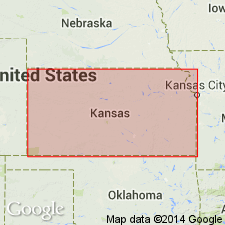
(Paleozoic Era; [Cambrian through Mississippian Systems] by E.D. Goebel, p. 14.) The St. Peter Sandstone and lower Simpson beds. The St. Peter Sandstone and the underlying green shale and sandstone, which occur near the Oklahoma border, are part of the Simpson Group. A shaly zone in the middle part of the St. Peter in northeastern Kansas becomes more prominent southward, and westward, near the Oklahoma border. Upper St. Peter Sandstone is underlain by beds of light-green and dark-green clay shale, sandy clay, and sandstone. An angular unconformity separates gently dipping St. Peter and associated Simpson beds from underlying rocks. The St. Peter overlies Precambrian and Upper Cambrian rocks on the Nebraska arch in northeastern Kansas. Abnormal thicknesses of St. Peter Sandstone, especially in eastern Kansas, are thought to represent sink-hole fillings (Lee et al, 1946, USGS Oil and Gas Inv. Prelim. Map, no. 48); Merriam and Atkinson (1956, Kansas Geol. Survey Oil and Gas Inv., no. 13, 28 p.). The thickness of the St. Peter Sandstone averages about 50 feet in northeastern Kansas. The St. Peter and associated Simpson rocks increase in thickness to 190 feet near the Oklahoma state line.
Source: Publication.
For more information, please contact Nancy Stamm, Geologic Names Committee Secretary.
Asterisk (*) indicates published by U.S. Geological Survey authors.
"No current usage" (†) implies that a name has been abandoned or has fallen into disuse. Former usage and, if known, replacement name given in parentheses ( ).
Slash (/) indicates name conflicts with nomenclatural guidelines (CSN, 1933; ACSN, 1961, 1970; NACSN, 1983, 2005, 2021). May be explained within brackets ([ ]).

