The National Geologic Map Database is migrating to a new infrastructure. We apologize for any service disruptions during this process.
|
|---|


- Usage in publication:
-
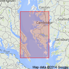
- St. Mary's formation
- Modifications:
-
- Named
- AAPG geologic province:
-
- Atlantic Coast basin
Shattuck, G.B., 1902, The Miocene problem of Maryland [abs.]: Science, new series, v. 15, p. 906.
Summary:
Divided Chesapeake Group into 3 formations; in ascending order, Calvert, Choptank, and St. Mary's formations. Formations have clearly defined faunas. No lithologic description in this paper.
Source: GNU records (USGS DDS-6; Reston GNULEX).
- Usage in publication:
-
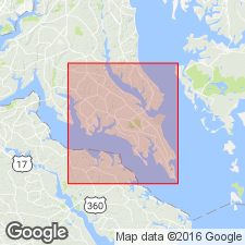
- St. Marys formation
- Modifications:
-
- Mapped
- Dominant lithology:
-
- Clay
- Marl
- AAPG geologic province:
-
- Atlantic Coast basin
Summary:
St. Marys formation. Fossiliferous sandy clay, clay, and marl, 140 feet thick. Top formation of Chesapeake group. Overlies Choptank formation. Age is Miocene.
Source: US geologic names lexicon (USGS Bull. 896, p.
- Usage in publication:
-
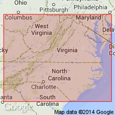
- St. Marys formation*
- Modifications:
-
- Areal extent
- Age modified
- AAPG geologic province:
-
- Atlantic Coast basin
Summary:
Correlation chart shows St. Marys formation in NC, VA, MD, and DE. Age is shown as middle and late Miocene.
Source: GNU records (USGS DDS-6; Reston GNULEX).
- Usage in publication:
-
- St. Marys Formation
- Modifications:
-
- Overview
- AAPG geologic province:
-
- Atlantic Coast basin
Summary:
The St. Marys Formation in DE consists of fossiliferous, glauconitic, lignitic, gray to bluish-gray clay to fine sandy clay. Contact with the underlying Choptank Formation is marked by a sharp clay on sand "kick." Contact may be conformable or unconformable. Phosphatic horizon above lower contact identified in MD by Hansen (1981) is not recognized in DE. Lithology apparently uniform throughout area, though updip contains a few sandy intervals. Deposited on muddy, shallow marine shelf. Underlies informal Manokin formation (of Andres, 1986). Upper contact ranges from abrupt to gradational. Age of St. Marys is late Miocene.
Source: GNU records (USGS DDS-6; Reston GNULEX).
- Usage in publication:
-
- St. Marys Formation
- Modifications:
-
- Overview
- AAPG geologic province:
-
- Atlantic Coast basin
GNU Staff, 1991, GNU Staff remark by R.C. Orndorff. St. Marys Formation.: U.S. Geological Survey Digital Data Series, DDS-6, 1 CD-ROM., release 3
Summary:
An unpublished manuscript by Ward and others (Ward, L.W., Andrews, G.W., and Mixon, R.B., 199_, Stratigraphy of the Calvert, Choptank, and St. Marys Formations (Miocene) in the Chesapeake Bay area, Maryland and Virginia: USGS Professional Paper) designates a lectostratotype for the St. Marys Formation as bluff on right bank of St. Marys River, 1.0 km upriver from Windmill Point, St. Marys Co., MD. These authors propose two members of the St. Marys as the Little Cove Point member and the Windmill Point member. If these two members are formalized the subunits for the St. Marys Formation would consist of the following members in ascending order: Conoy, Little Cove Point, and Windmill Point.
Source: GNU records (USGS DDS-6; Reston GNULEX).

- Usage in publication:
-
- St. Marys Formation
- Modifications:
-
- Overview
- AAPG geologic province:
-
- Atlantic Coast basin
Summary:
Chesapeake Group is undivided on the State map. However, its formations--Chowan River, Yorktown, Eastover, St. Marys, Choptank, and Calvert--are discussed in the text. St. Marys is a bluish- to pinkish gray, muddy, very fine sand and sandy clay-silt, locally abundantly shelly. Members are not discussed. Characteristic mollusks are CHESAPECTEN SANTAMARIA, BUCCINOFUSUS PARILIS,and ECPHORA GARDNERAE. Unit occurs northeast of Mattaponi River. Thickness is 0 to 40 ft. Age is middle and late Miocene.
Source: GNU records (USGS DDS-6; Reston GNULEX).
For more information, please contact Nancy Stamm, Geologic Names Committee Secretary.
Asterisk (*) indicates published by U.S. Geological Survey authors.
"No current usage" (†) implies that a name has been abandoned or has fallen into disuse. Former usage and, if known, replacement name given in parentheses ( ).
Slash (/) indicates name conflicts with nomenclatural guidelines (CSN, 1933; ACSN, 1961, 1970; NACSN, 1983, 2005, 2021). May be explained within brackets ([ ]).