The National Geologic Map Database is migrating to a new infrastructure. We apologize for any service disruptions during this process.
|
|---|


- Usage in publication:
-
- St. Leonard Member
- Modifications:
-
- Named
- Dominant lithology:
-
- Sand
- AAPG geologic province:
-
- Atlantic Coast basin
Summary:
St. Leonard Member of Choptank Formation named in southeastern MD. Consists of blue, green, and brown muddy sand, which ranges in thickness from 1 to 7 m. Conformably overlies Drumcliff Member (new name) and gradationally underlies Boston Cliffs Member (new name), both of Choptank Formation. Age is middle Miocene.
Source: GNU records (USGS DDS-6; Reston GNULEX).
- Usage in publication:
-
- St. Leonard Member*
- Modifications:
-
- Overview
- AAPG geologic province:
-
- Atlantic Coast basin
Summary:
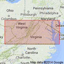
Sediments of the St. Leonard Member of the Choptank Formation lie between two major shell beds and vary considerably. At Calvert Cliffs, they are predominantly dusky blue to dusky greenish blue, muddy, fine sand to nearly silt. In VA, sediments are dusky olive to dark brown, slightly muddy to very muddy, fine to very fine sand. Thickness varies from about 5 ft to 22 ft. Unit is 19 ft 3 in. at the type section. Almost all surface occurrences are in the region west of the Chesapeake. There are no certain exposures on the Delmarva Peninsula. Lower contact with the underlying Drumcliff Member is nearly always sharp and distinct, occurring at the base of a tremendous decrease in the quantity of shells and occasionally at the base of deep channeling. The upper contact with the overlying Boston Cliffs Member is nearly always gradational and should be placed at the base of the first major influx of shells.
Source: GNU records (USGS DDS-6; Reston GNULEX).
For more information, please contact Nancy Stamm, Geologic Names Committee Secretary.
Asterisk (*) indicates published by U.S. Geological Survey authors.
"No current usage" (†) implies that a name has been abandoned or has fallen into disuse. Former usage and, if known, replacement name given in parentheses ( ).
Slash (/) indicates name conflicts with nomenclatural guidelines (CSN, 1933; ACSN, 1961, 1970; NACSN, 1983, 2005, 2021). May be explained within brackets ([ ]).