The National Geologic Map Database is migrating to a new infrastructure. We apologize for any service disruptions during this process.
|
|---|


- Usage in publication:
-
- St. Lawrence limestone
- Modifications:
-
- Original reference
- Dominant lithology:
-
- Limestone
- AAPG geologic province:
-
- Wisconsin arch
Summary:
Pg. 86 [Belle Plaine salt well], 132, 138-157. Divided the Paleozoic rocks of Minnesota Valley into (descending): Trenton limestones and shales; St. Peter sandstone; Lower Magnesian series (including Shakopee limestone, Jordan sandstone, and St. Lawrence limestone); and St. Croix sandstone. The sandstone underlying the Shakopee was in this report miscorrelated with Jordan sandstone; and the rocks below the sandstone were miscorrelated with the limestone at St. Lawrence, Minnesota, so that St. Lawrence limestone as here defined was applied to Oneota dolomite of later reports. Winchell herein described the St. Lawrence as a heavy calcareous formation underlying the Jordan sandstone, and stated that only 14.5 feet of it was exposed at St. Lawrence, [Scott County, southern Minnesota], the type locality. He also, in another place in same report, described it as "a great limestone formation which, while it differs considerably from the Shakopee stone, is still a magnesian limestone, and belongs to the same great series. It is harder than the Shakopee limestone, evenly bedded, quartzose, and specked with green. These green specks have somewhat the appearance of coming from metamorphism, yet they are caused by little rounded masses, which, if harder, would seem to have been water-worn and deposited with the sedimentation. They are, however, rather soft, cutting like talc. They exactly fill the cavities in which they lie. In some small portions they almost make up the bulk of the rock, which then has a green compact appearance, as it hornblendic. While the rock is evidently calcareous and magnesian in some parts, and almost destitute of these green specks, it is also siliceous and sharply crystalline.'' "The thickness of the next member [St. Lawrence limestone] of the Lower Magnesian has not yet been made out. It is visible at St. Lawrence, in Scott County, and at Judson, in Blue Earth County."
Source: US geologic names lexicon (USGS Bull. 896, p. 1878-1879).
- Usage in publication:
-
- St. Lawrence formation
- Modifications:
-
- Overview
- Dominant lithology:
-
- Shale
- Dolomite
- Limestone
- AAPG geologic province:
-
- Sioux uplift
Summary:
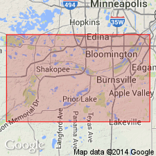
Type locality or section is located near the town of St. Lawrence on the Omaha division of the Chicago and Northwestern Railway, Scott Co, MN on the Sioux uplift. Though usually described as a limestone or dolomite, it also contains a lot of shale and sandstone. Glauconite is common. Section measured by Winchell (1872) is remeasured and redescribed. Winchell's section was 14.5 ft thick. The redescribed section is 31+ ft thick and that thickness may only represent the upper part. The St. Lawrence may be more than 100 ft thick. The redescribed section is 31.5 ft thick and is divided into: 1) basal gray arenaceous shale and thin sandy dolomite 17 ft thick; 2) buff sandy dolomite 1 ft thick; 3) gray to green arenaceous shale one-half ft thick; 4) dolomitic limestone and glauconite 4 ft thick; 5) brown to pink dolomitic limestone 2 ft thick; 6) buff to brown, porous, siliceous, dolomitic limestone 4 ft thick; 7) brown to buff to green mottled dolomitic limestone 3 ft thick. The lower 16 to 18 ft of the redescribed section were not included in the St. Lawrence by Winchell. Underlies Jordan sandstone at redescribed Jordan type section.
Source: GNU records (USGS DDS-6; Denver GNULEX).
- Usage in publication:
-
- St. Lawrence Formation
- Modifications:
-
- Overview
- Dominant lithology:
-
- Dolomite
- Siltstone
- AAPG geologic province:
-
- Wisconsin arch
Summary:
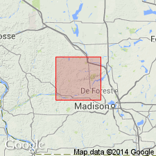
At this time, St. Lawrence Formation, which is about 10 m thick in study area, is considered to have just two subdivisions: the lower Black Earth Member (dolomite) and the upper Lodi Member (siltstone). Has previously been lumped with part or all of the overlying Jordan Sandstone and referred to the Trempealeau Group. Term Trempealeau is no longer used in WI in a lithostratigraphic sense. Black Earth is apparently absent in some northern parts of the county and thickens to no more than a few meters in the southern part. Interfingers with Lodi Member. Dolomite of the Black Earth contains varying amounts of quartzose and glauconitic silt and very fine sand. Commonly gray or brown with purple stains. Lodi Member makes up the bulk of the St. Lawrence. Though top and bottom rarely exposed, Lodi estimated at 10 m in Sauk Co. Consists primarily of pale yellow siltstone (when fresh) with uniform planar bedding, locally stained with various shades of red. Gray shale and beds of very fine grained sandstone also present. Siltstone is commonly dolomitic and slightly bioturbated. Some well preserved fossils. St. Lawrence overlies Lone Rock and Mazomanie Members of Tunnel City Formation (rank reduced).
Source: GNU records (USGS DDS-6; Reston GNULEX).
For more information, please contact Nancy Stamm, Geologic Names Committee Secretary.
Asterisk (*) indicates published by U.S. Geological Survey authors.
"No current usage" (†) implies that a name has been abandoned or has fallen into disuse. Former usage and, if known, replacement name given in parentheses ( ).
Slash (/) indicates name conflicts with nomenclatural guidelines (CSN, 1933; ACSN, 1961, 1970; NACSN, 1983, 2005, 2021). May be explained within brackets ([ ]).