The National Geologic Map Database is migrating to a new infrastructure. We apologize for any service disruptions during this process.
|
|---|


- Usage in publication:
-
- St. Laurent formation, limestone
- Modifications:
-
- Named
- Dominant lithology:
-
- Limestone
- Sandstone
- AAPG geologic province:
-
- Ozark uplift
Summary:
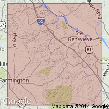
Named for St. Laurent Creek, Ste. Genevieve Co, MO, Ozark uplift, along which good exposures occur about 3 mi south of St. Marys. No type area designated. In Ste. Genevieve Co, St. Laurent occurs in three small outcrops within Little Saline faulted zone having a total area of less than 1/4 sq mi; also exposed in adjacent Perry Co, MO. St. Laurent has varying lithology though is predominately a hard and brittle, gray or blue-gray limestone; some beds are arenaceous limestone, sandstone, or chert. Thickness is 100-275 ft. Geologic map; measured section. Conformably overlies Beauvais formation (new); unconformably underlies Sulphur Springs formation. Stratigraphic chart. Fossils (listed) show strong affinity to formations of Hamilton (Middle Devonian) age in Ohio Valley and New York.
Source: GNU records (USGS DDS-6; Denver GNULEX).
- Usage in publication:
-
- St. Laurent Formation
- Modifications:
-
- Revised
- Overview
- AAPG geologic province:
-
- Ozark uplift
Summary:
Revised in that Beauvais Sandstone reduced to member rank and assigned to basal part of St. Laurent [not adopted by the Missouri Geol. Survey]. St. Laurent is confined to northwest-southeast outcrop belt in MO where it is exposed within Ste. Genevieve Fault Zone, Ozark uplift. Unconformably overlies Grand Tower Limestone; underlies Upper Devonian black shales. Maximum thickness is 85 m in St. Laurent Creek (type section), Perry Co, MO. Correlation chart. Based on correlation with Lingle Formation in IL, assigned late Eifelian and early Givetian (Middle Devonian) age.
Source: GNU records (USGS DDS-6; Denver GNULEX).
For more information, please contact Nancy Stamm, Geologic Names Committee Secretary.
Asterisk (*) indicates published by U.S. Geological Survey authors.
"No current usage" (†) implies that a name has been abandoned or has fallen into disuse. Former usage and, if known, replacement name given in parentheses ( ).
Slash (/) indicates name conflicts with nomenclatural guidelines (CSN, 1933; ACSN, 1961, 1970; NACSN, 1983, 2005, 2021). May be explained within brackets ([ ]).