The National Geologic Map Database is migrating to a new infrastructure. We apologize for any service disruptions during this process.
|
|---|


- Usage in publication:
-
- St. Joseph Island Volcanics*
- Modifications:
-
- Named
- Dominant lithology:
-
- Basalt
- Breccia
- Conglomerate
- Tuff
- AAPG geologic province:
-
- Alaska Southeastern region
Summary:
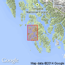
Named for St. Joseph Island, the designated type area, 3.2 km north of Noyes Island, off west coast of Prince of Wales Island, AK. Composed mainly of dark-green massive basaltic submarine flows, breccia, conglomerate and tuff that commonly shows good bedding. Is interlayered with minor siltstone, shale, and limestone. Basalt is amygdaloidal, massive, and has pillow structures. Thickness is between 7500 and 10,000 ft at type area; total thickness is unknown because neither top nor bottom is exposed. In fault contact with Descon Formation (new). Age is Devonian(?).
Source: GNU records (USGS DDS-6; Menlo GNULEX).
For more information, please contact Nancy Stamm, Geologic Names Committee Secretary.
Asterisk (*) indicates published by U.S. Geological Survey authors.
"No current usage" (†) implies that a name has been abandoned or has fallen into disuse. Former usage and, if known, replacement name given in parentheses ( ).
Slash (/) indicates name conflicts with nomenclatural guidelines (CSN, 1933; ACSN, 1961, 1970; NACSN, 1983, 2005, 2021). May be explained within brackets ([ ]).