- Usage in publication:
-
- St. Joe Limestone Member*
- Modifications:
-
- Revised
- AAPG geologic province:
-
- Arkoma basin
Summary:
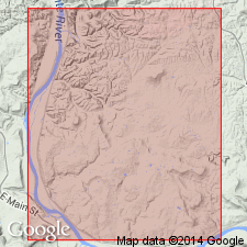
Walls Ferry Limestone, formerly of formation rank, reduced to a bed of the St. Joe Limestone Member of Boone Formation. [Though not stated in this report, Walls Ferry was shown as beneath the St. Joe in USGS Professional Paper 460 and it must, therefore, be the basal bed of the St. Joe.] Walls Ferry is a 32 cm thick gray to buff-gray fine-grained limestone that contains a varied invertebrate fauna (cephalopods, conodonts) which date the lower one-third as Kinderhookian and the upper two-thirds as Osagean. Walls Ferry is usually present where St. Joe is absent or poorly developed. The rest of the St. Joe is pinkish to reddish-gray encrinital limestone of Osagean age. Report area is in Independence Co, AR in the Arkoma basin.
Source: GNU records (USGS DDS-6; Denver GNULEX).
For more information, please contact Nancy Stamm, Geologic Names Committee Secretary.
Asterisk (*) indicates published by U.S. Geological Survey authors.
"No current usage" (†) implies that a name has been abandoned or has fallen into disuse. Former usage and, if known, replacement name given in parentheses ( ).
Slash (/) indicates name conflicts with nomenclatural guidelines (CSN, 1933; ACSN, 1961, 1970; NACSN, 1983, 2005, 2021). May be explained within brackets ([ ]).

