- Usage in publication:
-
- St. Hilaire Formation
- Modifications:
-
- Original reference
- AAPG geologic province:
-
- Sioux uplift
- Williston basin
Summary:
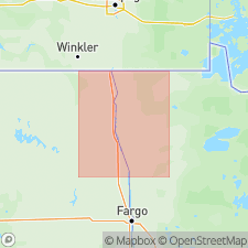
Pg. 5 (fig. 2), 7 (fig. 3), 10-11. St. Hilaire Formation. Gray (dry) and very dark gray (wet), unbedded pebble-loam. Consists of silt (38 to 46 percent), sand (30 to 40 percent), and clay 15 to 29 percent), and abundant pebbles and cobbles. Weak vertical joints common and result in a moderately columnar structure. Thickness 1 to 4 feet at type; thickness up to 20 feet southward. Its characteristic color makes it a useful stratigraphic marker. Overlies Marcoux Formation (new) with sharp contact; typically there is a cobble concentration or boulder pavement present. Underlies Red Lake Falls Formation (new) with sharp and gradational contact. Thought to extend into northeastern North Dakota, northwestern Minnesota, and southern Manitoba. Interpreted as a glacial sediment. Age is considered Wisconsinan or pre-Wisconsinan, based on stratigraphic relations.
Source: Publication.
For more information, please contact Nancy Stamm, Geologic Names Committee Secretary.
Asterisk (*) indicates published by U.S. Geological Survey authors.
"No current usage" (†) implies that a name has been abandoned or has fallen into disuse. Former usage and, if known, replacement name given in parentheses ( ).
Slash (/) indicates name conflicts with nomenclatural guidelines (CSN, 1933; ACSN, 1961, 1970; NACSN, 1983, 2005, 2021). May be explained within brackets ([ ]).

