

- Usage in publication:
-
- St. Charles formation*
- Modifications:
-
- Named
- Dominant lithology:
-
- Limestone
- Sandstone
- AAPG geologic province:
-
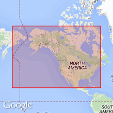
- Wasatch uplift
Summary:
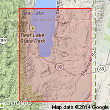
Named for exposures designated the type locality in Bear River Range, west of town of St. Charles in Bear Lake valley, Bear Lake Co, ID in Wasatch uplift. Composed of thin-bedded gray to brown sandstone (at base) and blue-gray to gray, arenaceous limestone with some cherty and concretionary. Is 1,225 ft thick in Blacksmith Fork Canyon; is 1,197 ft thick west of Liberty, ID. Overlies Nouveau formation (new). Contains Upper Cambrian fossils.
Source: GNU records (USGS DDS-6; Denver GNULEX).
- Usage in publication:
-
- St. Charles limestone*
- Modifications:
-
- Revised
- AAPG geologic province:
-
- Wasatch uplift
Summary:
A new member recognized at base of St. Charles limestone named the Worm Creek quartzite member. [Walcott (1908) did not include a quartzite with the St. Charles and he did not describe a quartzite as underlying the St. Charles.] Assigned to the Upper Cambrian.
Source: GNU records (USGS DDS-6; Denver GNULEX).
- Usage in publication:
-
- St. Charles limestone*
- Modifications:
-
- Areal extent
- AAPG geologic province:
-
- Wasatch uplift
- Snake River basin
Summary:
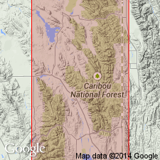
Geographically extended into southeast ID north of its type locality. Mapped (geologic map) at southwest side of Montpelier quad, Bear Lake Co, ID on the Wasatch uplift. Worm Creek quartzite member, basal member of St. Charles, also mapped. Three measured sections described. Is 1,200 ft thick at Mill Creek 5 mi west of Liberty, ID [Bingham Co, ID, Snake River basin], where the basal white quartzite (Worm Creek) is 250 ft thick and the overlying rocks are thin-bedded gray limestone. Is 1,000 ft thick on north side of Fish Haven Canyon in Bear Lake Co where the basal white quartzite (Worm Creek) is 200 ft thick and the overlying gray limestone is sandy at base and crystalline and crowded with Bryozoa at top. Is 950 ft thick on north side of St. Charles Creek in Bear Lake Co where the Worm Creek is 150 ft thick and divisible into a lower white quartzite and upper brown sandstone. The overlying part on St. Charles Creek is gray thin-bedded limestone with silicified Bryozoa? and trilobites. Has a considerable fauna (listed). Overlies Nounan limestone. Underlies Garden City limestone. Late Cambrian age assigned. Stratigraphic charts.
Source: GNU records (USGS DDS-6; Denver GNULEX).
- Usage in publication:
-
- St. Charles Formation*
- Modifications:
-
- Age modified
- Biostratigraphic dating
- AAPG geologic province:
-
- Wasatch uplift
- Great Basin province
Summary:
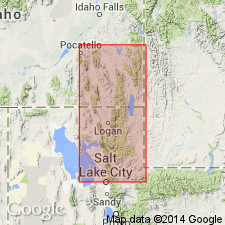
Conodont faunal sequences indicate that unnamed carbonate member of uppermost part of St. Charles Formation is of earliest Canadian (Early Ordovician) age, and contact between St. Charles and overlying Garden City Formation is disconformable, occurring within Canadian Series in Bear River Range area, Franklin Co, ID and Cache Co, UT, Wasatch uplift and Great Basin province. Change from reversed to normal polarity occurs at disconformity within Lower Ordovician trilobite zone SYMPHYSURINA. Duration of hiatus corresponded to HIRSUTODONTUS SIMPLEX and CLAVOHAMULUS HINTZEI subzones (Lower Ordovician) of CORDYLODUS PROAVUS Zone (uppermost Cambrian and Lower Ordovician).
Source: GNU records (USGS DDS-6; Denver GNULEX).
For more information, please contact Nancy Stamm, Geologic Names Committee Secretary.
Asterisk (*) indicates published by U.S. Geological Survey authors.
"No current usage" (†) implies that a name has been abandoned or has fallen into disuse. Former usage and, if known, replacement name given in parentheses ( ).
Slash (/) indicates name conflicts with nomenclatural guidelines (CSN, 1933; ACSN, 1961, 1970; NACSN, 1983, 2005, 2021). May be explained within brackets ([ ]).