The National Geologic Map Database is migrating to a new infrastructure. We apologize for any service disruptions during this process.
|
|---|


- Usage in publication:
-
- Squirrel Springs Canyon Andesite
- Modifications:
-
- Named
- Dominant lithology:
-
- Andesite
- AAPG geologic province:
-
- Basin-and-Range province
Summary:
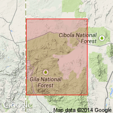
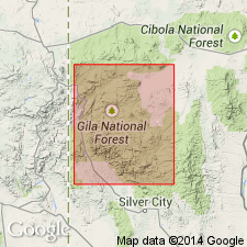
Named; derivation of name not given. Type area is northern Tularosa Mountains, Catron Co, NM, Basin-and-Range province. Unit is coarsely porphyritic andesite flows forming a conspicuous marker in the type area. The andesite is characterized by plagioclase phenocrysts 2 cm across, although fine-grained equigranular flows also occur. The porphyritic andesite is dark gray to reddish black and weathers to characteristically irregular blocky outcrops. In thin section, contains phenocrysts of slightly zoned plagioclase and iddingsite in a holocrystalline, felty groundmass. Iddingsite is commonly associated with relict olivine, and plagioclase and clinopyroxene are common groundmass constituents. Accessory minerals include iron oxides and apatite. Quartz is found as amygdules. The formation is equivalent to the upper andesite unit of Stearns (1962). At The Mesa, on the western end of the San Augustin Plains, the andesite interfingers with uppermost Tularosa Canyon Rhyolite, whereas in Tularosa Canyon and elsewhere it lies with a normal contact upon Tularosa Canyon Rhyolite. Composite stratigraphic column shows quartz latite ash-flow tuff (Apache Spring Quartz Latite?) as conformably overlying Squirrel Springs Canyon Andesite. Is more than 200 m thick to the east (Stearns, 1962), but thins generally to southwest and is 20-50 m thick in northern Tularosa Mountains. Of Oligocene age, based on stratigraphic position.
Source: GNU records (USGS DDS-6; Denver GNULEX).
- Usage in publication:
-
- Squirrel Springs Canyon Andesite
- Modifications:
-
- Geochronologic dating
- AAPG geologic province:
-
- Basin-and-Range province
Summary:
Has yielded a 24.3 +/-1.5 m.y [or Oligocene] date on plagioclase in Eagle Peak quad, Catron Co, NM, Basin-and-Range province.
Source: GNU records (USGS DDS-6; Denver GNULEX).
For more information, please contact Nancy Stamm, Geologic Names Committee Secretary.
Asterisk (*) indicates published by U.S. Geological Survey authors.
"No current usage" (†) implies that a name has been abandoned or has fallen into disuse. Former usage and, if known, replacement name given in parentheses ( ).
Slash (/) indicates name conflicts with nomenclatural guidelines (CSN, 1933; ACSN, 1961, 1970; NACSN, 1983, 2005, 2021). May be explained within brackets ([ ]).