The National Geologic Map Database is migrating to a new infrastructure. We apologize for any service disruptions during this process.
|
|---|


- Usage in publication:
-
- Squaw Peak Formation
- Modifications:
-
- Named
- Dominant lithology:
-
- Tuff
- Andesite
- AAPG geologic province:
-
- Modoc Plateau province
- Great Basin province
Summary:
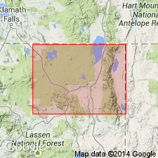
Named for exposures on east slope of Squaw Peak [Warren Peak 7.5' quad, Modoc Co, CA]. Contains at least 5 cooling units of rhyolite ash-flow tuff. Southward on east slope of Warren Peak, unit contains two andesite flows. Has maximum thickness of 800 ft. Stratigraphic chart shows unit overlies Lost Woods Formation (new) and underlies Owl Creek Formation (new). Age of units in study area (Warner Mountains) given as Tertiary.
[†/Squaw Peak Formation conflicts with several articles in nomenclature guidelines (ACSN, 1961, 1970; NACSN, 1983, 2005, 2021). Not adopted by the California Geological Survey or the USGS. Rocks included in Cedar Pass complex (informal). See Cedar Pass.]
Source: GNU records (USGS DDS-6; Menlo GNULEX).
For more information, please contact Nancy Stamm, Geologic Names Committee Secretary.
Asterisk (*) indicates published by U.S. Geological Survey authors.
"No current usage" (†) implies that a name has been abandoned or has fallen into disuse. Former usage and, if known, replacement name given in parentheses ( ).
Slash (/) indicates name conflicts with nomenclatural guidelines (CSN, 1933; ACSN, 1961, 1970; NACSN, 1983, 2005, 2021). May be explained within brackets ([ ]).