The National Geologic Map Database is migrating to a new infrastructure. We apologize for any service disruptions during this process.
|
|---|


- Usage in publication:
-
- Squares Tunnel Formation*
- Modifications:
-
- Original reference
- Biostratigraphic dating
- AAPG geologic province:
-
- Great Basin province
Summary:
Pg. J5 (fig. 3), J7-J8 (fig. 4), J18-J19, J29, J39. Squares Tunnel Formation. Previously informal Squares Tunnel beds (Stevens and Ridley, 1974, GSA Bull., v. 85); rocks included in Perdido Formation by some geologists. Consists of a lower, dominantly chert and argillite unit, 63 m thick, and an upper, conglomeratic limestone unit, about 7 m thick. Total thickness at type about 70 m; thins to about 10 m thick in Vaughn Gulch area, where it unconformably underlies the Kearsarge Formation (new) at its type locality. Unconformably overlies Silurian and Lower Devonian(?) Vaughn Gulch Limestone. Age is considered Late Devonian (late Famennian;TRACHYTERA to POSTERA zone of Ziegler and Sandberg, 1990).
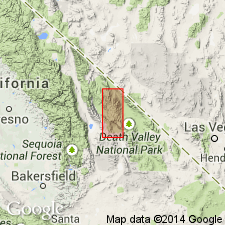
Type section: in Mazourka Canyon, 0.9 km north-northeast of Squares Tunnel and about 13 km northeast of Independence, in [S/2 sec. 30], T. 12 S., R. 36 E., Lat. 36 deg. 52 min. 12 sec. N., Long. 118 deg. 04 min. 54 sec. W., Bee Springs Canyon 7.5-min quadrangle [1994 ed.], west side of Inyo Mountains, Inyo Co., eastern CA. Named from Squares Tunnel (shown on Independence 15-min quadrangle). Present in northwestern-facies belt (base-of-slope and deep basinal environments), notable exposures (discontinuous) along western slopes of Inyo Mountains, Inyo Co., eastern CA.
Source: Publication.
For more information, please contact Nancy Stamm, Geologic Names Committee Secretary.
Asterisk (*) indicates published by U.S. Geological Survey authors.
"No current usage" (†) implies that a name has been abandoned or has fallen into disuse. Former usage and, if known, replacement name given in parentheses ( ).
Slash (/) indicates name conflicts with nomenclatural guidelines (CSN, 1933; ACSN, 1961, 1970; NACSN, 1983, 2005, 2021). May be explained within brackets ([ ]).