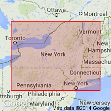
- Usage in publication:
-
- Springvale sandstone
- Modifications:
-
- Named
- Dominant lithology:
-
- Sandstone
Summary:
Lower portion of Onondaga limestone in region around Hagersville, Ontario, is usually arenaceous and very cherty --in some places an arenaceous chert and in others a true sandstone, as at Springvale, where lower part of Onondaga assumes such marked resemblance to true Oriskany that it has often been confused with it. But fauna is in every case Onondaga. Because of decided lithologic difference from ordinary appearance of formation to which they belong, the beds are here referred to as Springvale sandstone. Consists of 5.5 to 8 feet of coarse white to yellowish sandstone, lower part rather massive, upper layers somewhat irregular and seem to contain more fossils. Material doubtless reworked Oriskany sandstone. Rests unconformably on Oriskany sandstone or on eroded Silurian surface. Age is Middle Devonian.
Source: US geologic names lexicon (USGS Bull. 896, p. 2047).
For more information, please contact Nancy Stamm, Geologic Names Committee Secretary.
Asterisk (*) indicates published by U.S. Geological Survey authors.
"No current usage" (†) implies that a name has been abandoned or has fallen into disuse. Former usage and, if known, replacement name given in parentheses ( ).
Slash (/) indicates name conflicts with nomenclatural guidelines (CSN, 1933; ACSN, 1961, 1970; NACSN, 1983, 2005, 2021). May be explained within brackets ([ ]).

