The National Geologic Map Database is migrating to a new infrastructure. We apologize for any service disruptions during this process.
|
|---|


- Usage in publication:
-
- Springhill Pond Formation
- Modifications:
-
- Named
- Dominant lithology:
-
- Gneiss
- Quartzite
- Marble
- AAPG geologic province:
-
- Adirondack uplift
Summary:
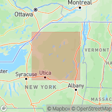
The informal Springhill Pond Formation of Walton and deWaard (1963) is here used and assigned to the Lake George Group in the eastern Adirondacks in NY. It consists of garnet-sillimanite gneiss, quartzite, and marble. Alling (1917) divided the sequence, from base to top, into tentative units: Hague gneiss, Dixon schist, Faxon limestone, Swede Pond quartzite, (Bryant Lake) limestone, Catamount sillimanite schist, Bear Pond schist. Structurally overlies the Lake Durant Formation; structurally underlies the Thunderbolt Mountain Formation, both of the Lake George Group. Correlates with the Blue Mountain Lake Formation of the central Adirondacks. Age is Proterozoic.
Source: GNU records (USGS DDS-6; Reston GNULEX).
For more information, please contact Nancy Stamm, Geologic Names Committee Secretary.
Asterisk (*) indicates published by U.S. Geological Survey authors.
"No current usage" (†) implies that a name has been abandoned or has fallen into disuse. Former usage and, if known, replacement name given in parentheses ( ).
Slash (/) indicates name conflicts with nomenclatural guidelines (CSN, 1933; ACSN, 1961, 1970; NACSN, 1983, 2005, 2021). May be explained within brackets ([ ]).