- Usage in publication:
-
- Springfield stone, limestone
- Modifications:
-
- Named
- Dominant lithology:
-
- Limestone
- Dolomite
- AAPG geologic province:
-
- Cincinnati arch
Summary:
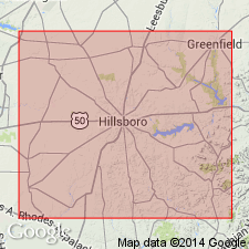
Springfield stone or limestone, also called Blue Cliff, is a massive blue crinoidal limestone with some buff and drab beds and interstratified shale or blue clay, and with 5 to 15 ft of blue shale at base. Thickness 20 to 45 ft. Overlain by Cedarville or Guelph limestone and underlain by West Union or Lower Cliff limestone. All included in Niagara group. Occurs in Highland Co., southwestern OH, and northward. Age is Silurian.
Source: GNU records (USGS DDS-6; Reston GNULEX).

- Usage in publication:
-
- Springfield limestone
- Modifications:
-
- Overview
- AAPG geologic province:
-
- Cincinnati arch
Summary:
Type locality of Springfield limestone, introduced by Orton in 1871, is Springfield, OH, where this formation has long been quarried west of the city where the typical well-bedded fine-grained Springfield dolomite is 10 ft thick. The underlying dense, but somewhat mottled rock is 4 ft thick, giving 14 ft for entire Springfield dolomite section, which rests directly on Euphemia dolomite. It is overlain by Cedarville dolomite.
Source: GNU records (USGS DDS-6; Reston GNULEX).

- Usage in publication:
-
- Springfield limestone*
- Modifications:
-
- Overview
- AAPG geologic province:
-
- Cincinnati arch
Summary:
Orton's (1871) definition of Springfield limestone was used in Ohio Geological Survey reports in 1873, 1874, 1884, 1893, 1905, 1915, and 1916 and as of this publication date is still followed by that Survey. In 1917, A.F. Foerste introduced Euphemia dolomite for the beds underlying Springfield dolomite, as he called the formation, and included (ascending) Euphemia dolomite, Springfield dolomite, and Cedarville dolomite in his Durbin formation. It appears that Foerste's Springfield dolomite is only a part of Orton's Springfield limestone.
Source: GNU records (USGS DDS-6; Reston GNULEX).

- Usage in publication:
-
- Springfield dolomite
- Modifications:
-
- Revised
- AAPG geologic province:
-
- Cincinnati arch
Summary:
Chart 3. Shown on correlation chart as Springfield dolomite of Durbin group. [Age is Middle Silurian.]
Source: US geologic names lexicon (USGS Bull. 1200, p. 3695-3696).

- Usage in publication:
-
- Springfield stone
- Modifications:
-
- Not used
- Overview
- AAPG geologic province:
-
- Cincinnati arch
Summary:
Unit now referred to Lilley Formation was part of Cliff limestone of Locke (1838) and was called Springfield stone by Orton (1871).
Source: GNU records (USGS DDS-6; Reston GNULEX).
For more information, please contact Nancy Stamm, Geologic Names Committee Secretary.
Asterisk (*) indicates published by U.S. Geological Survey authors.
"No current usage" (†) implies that a name has been abandoned or has fallen into disuse. Former usage and, if known, replacement name given in parentheses ( ).
Slash (/) indicates name conflicts with nomenclatural guidelines (CSN, 1933; ACSN, 1961, 1970; NACSN, 1983, 2005, 2021). May be explained within brackets ([ ]).

