The National Geologic Map Database is migrating to a new infrastructure. We apologize for any service disruptions during this process.
|
|---|


- Usage in publication:
-
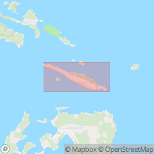
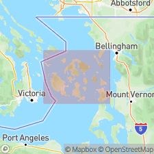
- Spieden Bluff Formation
- Modifications:
-
- Named
- Biostratigraphic dating
- Geochronologic dating
- Dominant lithology:
-
- Conglomerate
- Sandstone
- AAPG geologic province:
-
- Puget Sound province
Summary:
Named as lower formation of Spieden Group. Type section: Spieden Bluff on northwest coast of Spieden Island, sec 2, T37N, R4W. Formerly lower part of Spieden Formation. Chiefly 100 m volcanic breccia-conglomerate, sandstone, siltstone, and tuff divided into two informal members. Lower member debris flow; upper shallow marine. Base not exposed; unconformably overlain by Lower Cretaceous Sentinel Island Formation. Age from BUCHIA CONCENTRICA (Oxfordian or Kimmeridgian) in upper member and hornblende K-Ar date of 148+-9 Ma in lower member. Crops out San Juan Islands only.
Source: GNU records (USGS DDS-6; Menlo GNULEX).
- Usage in publication:
-
- Spieden Bluff Formation*
- Modifications:
-
- Geochronologic dating
- AAPG geologic province:
-
- Puget Sound province
Summary:
Sample 26 on granodiorite clast of Spieden Formation of Spieden Group gave fission-track age of 147 +/-16 Ma.
Source: GNU records (USGS DDS-6; Menlo GNULEX).
For more information, please contact Nancy Stamm, Geologic Names Committee Secretary.
Asterisk (*) indicates published by U.S. Geological Survey authors.
"No current usage" (†) implies that a name has been abandoned or has fallen into disuse. Former usage and, if known, replacement name given in parentheses ( ).
Slash (/) indicates name conflicts with nomenclatural guidelines (CSN, 1933; ACSN, 1961, 1970; NACSN, 1983, 2005, 2021). May be explained within brackets ([ ]).