

- Usage in publication:
-
- Spellman Formation
- Modifications:
-
- Named
- Dominant lithology:
-
- Limestone
- AAPG geologic province:
-
- Appalachian basin
Summary:
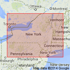
Spellman Formation of Beekmantown Group. Name introduced for fossiliferous limestones and dolomitic limestone that constitute "type" Beekmantown at Spellman Ledge at Beekmantown, New York, in Rouses Point quadrangle. Thickness about 25 feet, neither top nor bottom exposed. Limits set somewhat vaguely, lithologically medial Canadian age (LECANOSPIRA zone).
Named for exposures at Spellman Ledge, 1.5 mi south of Spellman Rd at Beekmantown, in Rouses Point quadrangle, northeastern NY. Well exposed at Willsboro on Bouquet River and in field exposures, 4 mi south-southeast of Fort Ann.
Source: US geologic names lexicon (USGS Bull. 1350, p. 714).
For more information, please contact Nancy Stamm, Geologic Names Committee Secretary.
Asterisk (*) indicates published by U.S. Geological Survey authors.
"No current usage" (†) implies that a name has been abandoned or has fallen into disuse. Former usage and, if known, replacement name given in parentheses ( ).
Slash (/) indicates name conflicts with nomenclatural guidelines (CSN, 1933; ACSN, 1961, 1970; NACSN, 1983, 2005, 2021). May be explained within brackets ([ ]).