

- Usage in publication:
-
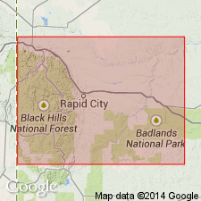
- Spearfish formation*
- Modifications:
-
- First used
- Dominant lithology:
-
- Redbeds
- AAPG geologic province:
-
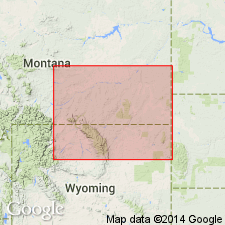
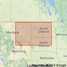
- Williston basin
- Chadron arch
- Powder River basin
Summary:
First use of name. Intent to name not stated, and no type locality designated. Probably named for Spearfish, Lawrence Co, SD in Williston basin. Typical sections measured in 12 localities in the Black Hills, SD and WY, Williston and Powder River basins and on Chadron arch. Described as redbeds unconformably underlying Jurassic Sundance formation (new). Contact with Sundance formation described at several localities on the south and east sides of the Black Hills in western SD, and at Cambria on western side of Black Hills, in WY. Thickness not given. Underlying formation not identified. Assigned a Triassic age --basis for assignment not given.
Source: GNU records (USGS DDS-6; Denver GNULEX).
- Usage in publication:
-
- Spearfish formation*
- Modifications:
-
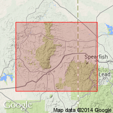
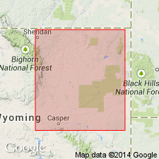
- Areal extent
- Overview
- AAPG geologic province:
-
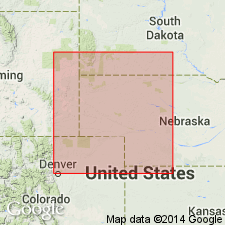
- Denver basin
Summary:
Extended geographically from the Black Hills area, SD to the Hartville area, Platte Co, WY in the Denver basin. Conformably overlies Permian Minnekahta limestone and underlies Jurassic Sundance formation, both formations also extended into the area. Occurs in northwest part of quad. Is about 450 ft thick. Consists of red-brown soft sandstone of medium and nearly uniform size and locally ripple marked. White gypsum common as thin sheets separated by sandstone in the lower half of the formation. No fossils found. Geologic map. Columnar section. New evidence found since report was written suggests Spearfish is Permian age.
Source: GNU records (USGS DDS-6; Denver GNULEX).
- Usage in publication:
-
- Spearfish formation*
- Modifications:
-
- Overview
- AAPG geologic province:
-
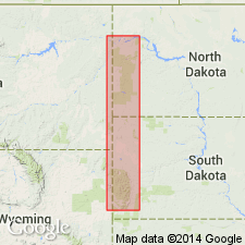
- Williston basin
Summary:
The upper red sandy shales of Chugwater formation (a new name) in the Big Horn Mountains, Bighorn and Powder River basins, are thought to correlate with Triassic? Spearfish formation of the Black Hills. Correlation diagram.
Source: GNU records (USGS DDS-6; Denver GNULEX).
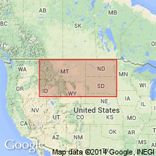
- Usage in publication:
-
- Spearfish formation
- Modifications:
-
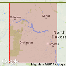
- Areal extent
- AAPG geologic province:
-
- Chadron arch
Summary:
Name extended southward in the subsurface into northeastern NE on the Chadron arch. Identified in the Duthie well, sec 33, T25N, R47W, Dawes Co, NE for red shale, sand, and lime at depths of 1503-1825 ft. Overlain by Sundance formation; underlain by Minnekahta limestone. Tentatively identified, also, in a well in Frontier CO, southwestern NE on Chadron arch. Triassic in age.
Source: GNU records (USGS DDS-6; Denver GNULEX).
- Usage in publication:
-
- Spearfish formation
- Modifications:
-
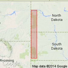
- Areal extent
- AAPG geologic province:
-
- Williston basin
Summary:
Extends name into southeast MT in the Montana-Dakota Utilities Co., No. 1 Northern Pacific Railroad Co. well, sec 17, T4N, R62E, Fallon Co, MT. Consists of: an upper unit of red shale, anhydrite, green shale, and brown fossiliferous limestone extending from a depth of 4,586 to 4,785 ft; next lower unit is red shale, a little anhydrite, a little sand, traces of limestone extending from a depth of 4.785 to 5,000 ft; next lower unit is red shale, salt, and traces of anhydrite extending from a depth of 5,000 to 5,360 ft; lowest unit is red shale, and traces of anhydrite extending from a depth of 5,360 to 5,463 ft. Overlain by Sundance formation; underlain by Minnekahta limestone. Is Triassic and Permian? in age.
Source: GNU records (USGS DDS-6; Denver GNULEX).
- Usage in publication:
-
- Spearfish formation
- Modifications:
-
- Revised
- AAPG geologic province:
-
- Chadron arch
- Denver basin
Summary:
Pg. 2, 6; 1950, Nebraska Geol. Survey Bull. 13-A, p. 9. Spearfish formation. Redefined to apply to section between Phosphoria group and the Sundance, or at places, the section from the Phosphoria to base of Jelm formation; in places where Dinwoody is present, to the interval between the Dinwoody and the Sundance. Consists of red shales and sands, 550 feet or less. [Gypsiferous beds included in basal Spearfish formation by Darton, 1901 (USGS 21st Ann. Rpt., pt. 4, Hot Springs, South Dakota) are considered Permian and transferred to underlying Phosphoria group.] Age is Triassic.
Source: Publication; US geologic names lexicon (USGS Bull. 1200, p. 3678); supplemental information from GNU records (USGS DDS-6; Denver GNULEX).
- Usage in publication:
-
- Spearfish formation
- Modifications:
-
- Revised
- Areal extent
- Overview
- AAPG geologic province:
-
- Williston basin
Summary:
Spearfish formation. Upper contact with Sundance formation lowered 209 feet (from a depth of 4,586 feet to a depth of 4,795 feet) in the Montana-Dakota Utilities Company No. 1 Northern Pacific well, Fallon County, Montana; interval previously assigned to uppermost Spearfish by DeWolf and West (1939, AAPG Bull., v. 26, no. 4). A sandy zone at top appears to be truncated from north to south and is probably absent from outcrops in the Black Hills. Overlies Minnekahta limestone; unconformably underlies Sundance formation. Age is Permian and Triassic.
Source: Modified from GNU records (USGS DDS-6; Denver GNULEX).
- Usage in publication:
-
- Spearfish formation*
- Modifications:
-
- Revised
- AAPG geologic province:
-
- Williston basin
- Powder River basin
Summary:
Revised to exclude Middle Jurassic Gypsum Spring formation herein recognized as extending into the northwestern part of the Black Hills area in the Williston and Powder River basins, and formerly included at top of Spearfish formation. Contact with overlying Gypsum Spring formation unconformable. Upper part Triassic in age; lower part not discussed.
Source: GNU records (USGS DDS-6; Denver GNULEX).
- Usage in publication:
-
- Spearfish formation
- Modifications:
-
- Revised
- Overview
- AAPG geologic province:
-
- Williston basin
Summary:
Restricted to the lowest of four units in the red-bed sequence in the Williston basin that underlies marine strata of Middle Jurassic age, and that overlies either Minnekahta limestone of Permian age or post-Paleozoic unconformity where the Minnekahta has been removed by erosion. Consists of reddish-brown mudstone with minor amounts of reddish-orange siltstone. Inclusions of anhydrite not uncommon. Conformably overlies Minnekahta limestone; is separated from overlying Pine salt (new) by an erosional unconformity, which is considered to be the major unconformity separating strata of Middle Jurassic age from Spearfish formation at the surface [in the Black Hills]. Map shows extent of formation (restricted) in western ND and adjoining SD and MT. Maximum thickness [from isopach map] about 400 ft at the southeast corner of MT, thinning generally northeastward. Is an erosional wedge of Spearfish formation of the Black Hills. Age not mentioned, but presumably Triassic and Permian.
Source: GNU records (USGS DDS-6; Denver GNULEX).
- Usage in publication:
-
- Spearfish formation*
- Modifications:
-
- Revised
- AAPG geologic province:
-
- Williston basin
- Powder River basin
Summary:
Contact with overlying Gypsum Spring formation everywhere at the base of thick beds of gypsum or beds of brecciated gypsiferous limestone in the northwestern part of the Black Hills, in Williston and Powder River basins. Sundance formation bevels across the Gypsum Spring onto Spearfish formation from northwest to southeast. Upper part is Triassic in age; lower part not described.
Source: GNU records (USGS DDS-6; Denver GNULEX).
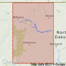
- Usage in publication:
-
- Spearfish formation*
- Modifications:
-
- Redescribed
- Areal extent
- AAPG geologic province:
-
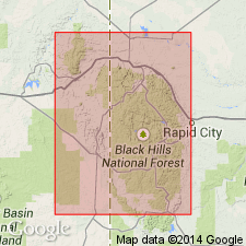
- Williston basin
Summary:
In ND is redescribed as a sequence of brick-red to brown sandstones, siltstones, and shales with two major salt sections called (descending) the Triassic "A" and Triassic "B" salts. The salt units correspond, respectively, to Dunham and Pine salts of Zieglar (1955). Overlain by Piper formation; underlain by Minnekahta limestone. Isopach maps show the thickness and distribution of the Triassic "A" and "B" salts in ND, in Williston basin. Is Triassic in age.
Source: GNU records (USGS DDS-6; Denver GNULEX).
- Usage in publication:
-
- Spearfish formation
- Modifications:
-
- Revised
- Overview
- Age modified
- AAPG geologic province:
-
- Williston basin
- Chadron arch
Summary:
Divided into four lithologic units in the Black Hills, SD, and in the subsurface in Williston basin, ND. These are designated (descending): units A to D, corresponding in the Williston basin to Dunham salt, Saude formation, Pine salt, and Spearfish formation (restricted), respectively, of Zieglar (1955). Units A and B assigned to the Upper Triassic; unit C to the Lower Triassic; and unit D to the Lower Triassic and Permian. Identifies these units in a measured section at Buffalo Gap, Custer Co., SD, on Chadron arch. Hiatus representing Middle Triassic time postulated at top of unit C (Pine salt). Triassic and Permian in age. Abandons subdivision of Condra, Reed, and Scherer (1940) into Spearfish formation (restricted) and underlying upper part of Phosphoria group in the eastern Black Hills. See columns 68 and 69.
Source: GNU records (USGS DDS-6; Denver GNULEX).
- Usage in publication:
-
- Spearfish formation
- Modifications:
-
- Revised
- AAPG geologic province:
-
- Powder River basin
Summary:
Revised in the subsurface on the east side of Powder River basin to exclude from the base rocks assigned to Goose Egg formation. Correlation shown in twelve wells in Natrona, Johnson, Sheridan, Campbell, and Crook Cos, northeast WY. Spearfish and Chugwater formations are correlative throughout Powder River basin, except that equivalents of the Crow Mountain sandstone and Alcova limestone [members of Chugwater Formation] are not present in the Spearfish and appear to be missing by erosion or nondeposition in the eastern part of the basin. Triassic in age.
Source: GNU records (USGS DDS-6; Denver GNULEX).
- Usage in publication:
-
- Spearfish formation*
- Modifications:
-
- Revised
- Overview
- Age modified
- AAPG geologic province:
-
- Williston basin
- Powder River basin
- Chadron arch
Summary:
Revised to exclude Dunham salt of Zieglar (1955), or unit A of Lewis and Hadley (1957) in the Williston basin. The Triassic-Permian boundary placed at top of the salt unit of Spearfish [Pine salt] in Williston basin, and at top of a persistent anhydrite [or gypsum] bed [at about the top of the lower gypsiferous part of Spearfish] in the Black Hills area of SD and WY, on Chadron arch and in the Williston and Powder River basins. Is Early Triassic and Late Permian (Guadalupian) in age based on apparent stratigraphic continuity with better-dated rocks in central WY.
Source: GNU records (USGS DDS-6; Denver GNULEX).
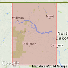
- Usage in publication:
-
- Spearfish Formation
- Modifications:
-
- Revised
- Overview
- AAPG geologic province:
-
- Williston basin
Summary:
Divided in the subsurface in western ND in ascending order into a lower gray shale and red siltstone unit, a middle salt unit, and an upper red siltstone, shale, and fine-grained sandstone unit, called, respectively: the lower shale member, Pine Salt Member, and Saude Member. The last two names are used in the sense of Zieglar (1955), except that the contact between the members is lowered to accommodate within the Saude Member a persistent siltstone unit, and an overlying, equally persistent, anhydrite and salt unit referred to as the G marker bed. The lower shale and Pine Salt Members are considered Permian in age. The Saude Member is considered primarily Triassic in age, although it may contain the Triassic-Jurassic boundary in extreme northern ND and Canada. The G marker bed in Saude Member is correlated with the top of Goose Egg Formation of WY. Conformably overlies Minnekahta Limestone, except at the eastern margin of the basin, where it unconformably overlies older rocks; unconformably underlies Piper Formation. Shows isopach maps and correlation diagrams.
Source: GNU records (USGS DDS-6; Denver GNULEX).
- Usage in publication:
-
- Spearfish Formation
- Modifications:
-
- Overview
- AAPG geologic province:
-
- Williston basin
Summary:
An expanded version of Dow (1964). Divides Spearfish in the subsurface of Williston basin, western ND into (ascending): Belfield (new), Pine Salt, and Saude Members. Overlain by anhydrite and salt beds assigned to Poe Member of Piper Formation [formerly Poe evaporite member of Nesson formation]. Belfield and Pine Salt Members are correlated with the Permian part of Spearfish Formation in outcrop sections in the Black Hills, WY and SD. Maps and correlation diagrams show extent of the formation and its members in western ND. Is Triassic and Late Permian in age, except in northern part of Williston basin, where it may contain beds of Early Jurassic age at top.
Source: GNU records (USGS DDS-6; Denver GNULEX).
- Usage in publication:
-
- Spearfish Formation*
- Modifications:
-
- Revised
- Overview
- AAPG geologic province:
-
- Williston basin
Summary:
Revised downward the upper contact in the subsurface in the Williston basin. Includes (ascending): a lower unnamed part, Pine Salt of Zieglar (1955) and its equivalents in WY and SD, and an unnamed upper part. Underlain conformably by Minnekahta Limestone. In the central part of the basin, overlain unconformably by Saude Formation of Zieglar (1955). Where Saude Formation pinches out in the southern [and western] parts of the basin, unconformably overlain by Gypsum Spring Formation, or by Piper Formation. In most of the Williston basin [north of the Black Hills], the upper part of Pine Salt [and overlying part of Spearfish Formation] seems to be absent so that Saude Formation of Zieglar (1955) [unconformably] overlies halite of Permian age [in Spearfish]. Is Late Permian and Early Triassic in age based on correlations with Goose Egg and overlying Chugwater Formations in WY. Shows correlation in wells in southeastern MT and northwestern WY.
Source: GNU records (USGS DDS-6; Denver GNULEX).
For more information, please contact Nancy Stamm, Geologic Names Committee Secretary.
Asterisk (*) indicates published by U.S. Geological Survey authors.
"No current usage" (†) implies that a name has been abandoned or has fallen into disuse. Former usage and, if known, replacement name given in parentheses ( ).
Slash (/) indicates name conflicts with nomenclatural guidelines (CSN, 1933; ACSN, 1961, 1970; NACSN, 1983, 2005, 2021). May be explained within brackets ([ ]).