- Usage in publication:
-
- South Rim Formation
- Modifications:
-
- Revised
- AAPG geologic province:
-
- Permian basin
Summary:
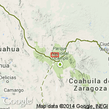
Revised in that the South Rim Formation divided into, from oldest to youngest: Pine Canyon Rhyolite [Member], (new); Boot Rock member (new, informal); Lost Mine Member; lava domes; Wasp Spring Member [reduced in rank from formation]; Burro Mesa Rhyolite [Member]; and quartz-phric dikes. Rocks of the South Rim were emplaced during three episodes; second episode produced lava flows and ash-flow tuffs of quartz trachyte; first and third produced ash-flow tuffs of peralkaline rhyolite. Is related to the Pine Canyon caldera. Occurs in the Chisos Mountains of Big Bend National Park in west TX, Permian basin. Of Oligocene age.
Source: GNU records (USGS DDS-6; Denver GNULEX).

- Usage in publication:
-
- South Rim Formation
- Modifications:
-
- Geochronologic dating
- AAPG geologic province:
-
- Permian basin
Summary:
Pg. 25. South Rim Formation. Samples from (ascending) Wasp Spring Member, Lost Mine Member, and Burro Mesa Rhyolite [Member], in Big Bend area, Brewster County, southwestern Texas, yielded K-Ar ages from 33.3 +/-0.7 Ma to 30.1 +/-0.9 Ma (alkali feldspar). Data from D.S. Barker and others, 1986 (Univ. Texas-Austin Bur. Econ. Geol. Gdbk. 23), S.W. Becker, 1976 (Univ. Calif. Santa Cruz MS thesis, 116 p.), R.A. Maxwell and others, 1967 (Univ. Texas-Austin Pub. 6711, 320 p.), and D.S. Ogley, 1979 (Univ. Texas-Austin Bur. Econ. Geol. Gdbk. 19, p. 67-71); ages recalculated using decay constants of Steiger and Jager, 1977 (Earth Planet. Sci. Letters, v. 36, p. 359-362). [See also entries under individual members.]
[Age considered Oligocene; Eocene-Oligocene boundary 36.6 (38-34) Ma (from Geologic Names Committee, USGS, 1983 ed. geol. time scale, with additions from N.J. Snelling, 1985, The Geol. Soc. Mem., no. 10).]
Source: Publication.
For more information, please contact Nancy Stamm, Geologic Names Committee Secretary.
Asterisk (*) indicates published by U.S. Geological Survey authors.
"No current usage" (†) implies that a name has been abandoned or has fallen into disuse. Former usage and, if known, replacement name given in parentheses ( ).
Slash (/) indicates name conflicts with nomenclatural guidelines (CSN, 1933; ACSN, 1961, 1970; NACSN, 1983, 2005, 2021). May be explained within brackets ([ ]).

