- Usage in publication:
-
- South Pass Formation*
- Modifications:
-
- Named
- Dominant lithology:
-
- Conglomerate
- Sandstone
- Limestone
- AAPG geologic province:
-
- Wind River basin
Summary:
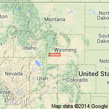
Named for area around South Pass, Ts28 and 29N, R98 through 103W, Fremont Co, WY in Wind River basin. Formerly designated basal White River Formation or as middle and upper Eocene rocks. Composed of pinkish-gray pebble to boulder conglomerate that has a fine-grained tuffaceous sandstone and siltstone matrix at base. The conglomerate has pebbles of moss agate, and is locally interbedded with very coarse-grained arkosic sandstone. Fine- to coarse-grained, laminated, strongly fluorescent sandstone as much as 200 ft thick and fresh-water limestone and volcanic ash as much as 15 ft thick are in the upper part. Formation ranges from 0-500+ ft thick. On south side Sweetwater River boulders and cobbles of Precambrian metamorphic and igneous rocks are in a matrix of fine-grained tuffaceous siltstone reworked from the White River Formation and the tuffaceous sandstone from lower and middle Miocene rock. Overlies unconformably rocks of Precambrian, early and middle Eocene, and early and middle Miocene age. Fills preexisting valleys. Forms pediment and coalescing alluvial fanlike deposits along both flanks at south end Wind River Mountains. Noted for its heterogeneous content and abrupt change in lithologic content. Geologic map. Mapped as irregular discontinuous patches over about 350 sq mi. Exact age unknown except for stratigraphic position and its similarity to rocks assigned to Ogallala. Assigned to late Miocene to middle Pliocene.
Source: GNU records (USGS DDS-6; Denver GNULEX).
For more information, please contact Nancy Stamm, Geologic Names Committee Secretary.
Asterisk (*) indicates published by U.S. Geological Survey authors.
"No current usage" (†) implies that a name has been abandoned or has fallen into disuse. Former usage and, if known, replacement name given in parentheses ( ).
Slash (/) indicates name conflicts with nomenclatural guidelines (CSN, 1933; ACSN, 1961, 1970; NACSN, 1983, 2005, 2021). May be explained within brackets ([ ]).

