

- Usage in publication:
-
- South Fork Tuff*
- Modifications:
-
- Named
- Dominant lithology:
-
- Tuff
- Rhyolite
- AAPG geologic province:
-
- San Luis basin
Summary:
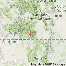
Named as a formation within Treasure Mountain Group (rank raised) for town of South Fork located along Rio Grande, Rio Grande Co, CO (San Luis basin). Type locality designated as east of mouth of Willow Creek, about 3 km east of South Fork where unit is well exposed and readily accessible. Unit is petrologically distinctive low-silica rhyolitic tuff typically containing 10-15% phenocrysts of plagioclase, sanidine, biotite, and augite. Previously referred to as upper tuff of Treasure Mountain Tuff (Lipman, 1975, USGS Prof. Paper 852) or lower rhyolitic unit of Masonic Park Tuff (Dungan and others, 1989, New Mexico Bur. Mines and Min. Res. Mem. 46). Assigned to Treasure Mountain because distribution is similar to north and west flank extents of other Treasure Mountain units; unit was erupted from Platoro area; and age is indistinguishable from underlying Ra Jadero Tuff (rank raised) of Treasure Mountain. Occurs on north and northwest flanks of Platoro caldera complex of San Juan volcanic field. Exposures in South Fork area are a distal facies; tuff sheet is thicker, more densely welded, and more phenocryst rich closer to caldera complex. Most distal exposures are north of South Fork and on Agua Ramon Mountain. Total volume is estimated at 50 cu km (table 1). Overlies Ra Jadero; underlies Chiquito Peak Tuff (new) of Treasure Mountain. Ar-Ar age is 28.74 Ma (Oligocene) (table 1).
Source: GNU records (USGS DDS-6; Denver GNULEX).
For more information, please contact Nancy Stamm, Geologic Names Committee Secretary.
Asterisk (*) indicates published by U.S. Geological Survey authors.
"No current usage" (†) implies that a name has been abandoned or has fallen into disuse. Former usage and, if known, replacement name given in parentheses ( ).
Slash (/) indicates name conflicts with nomenclatural guidelines (CSN, 1933; ACSN, 1961, 1970; NACSN, 1983, 2005, 2021). May be explained within brackets ([ ]).