- Usage in publication:
-
- South Fork limestone member
- Modifications:
-
- Original reference
- Dominant lithology:
-
- Limestone
- Shale
- AAPG geologic province:
-
- Forest City basin
- Nemaha anticline
Summary:
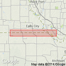
Pg. 5, 10. South Fork limestone member of Burlingame limestone formation of Wabaunsee group. Burlingame limestone formation divided into (descending): (1) South Fork limestone (one massive bed, or 2 or 3 beds, separated by shale, 2.5 feet); (2) Winnebago shale (bluish, argillaceous, some limy fossiliferous seams, 8 to 12 feet); (3) Taylor Branch limestone (bluish gray, massive, weathering brownish, 2 to 4.5 feet). The South Fork lies high in hill 0.75 mi southwest of Du Bois [Pawnee County, southeastern Nebraska], at west side of South Fork Valley; type of the Winnebago is in Missouri River bluffs south of mouth of Winnebago Creek, north of Rulo, Richardson Co., Nebraska; the Taylor Branch is lowest heavy limestone at top of opening in clay pit south of Taylor Branch, south of Table Rock, Nebraska. These members have been traced through Kansas to Oklahoma. Age is Late Pennsylvanian (Virgil).
Source: US geologic names lexicon (USGS Bull. 896, p. 2031); GNC KS-NE Pennsylvanian Corr. Chart, sheet 2, Oct. 1936.
For more information, please contact Nancy Stamm, Geologic Names Committee Secretary.
Asterisk (*) indicates published by U.S. Geological Survey authors.
"No current usage" (†) implies that a name has been abandoned or has fallen into disuse. Former usage and, if known, replacement name given in parentheses ( ).
Slash (/) indicates name conflicts with nomenclatural guidelines (CSN, 1933; ACSN, 1961, 1970; NACSN, 1983, 2005, 2021). May be explained within brackets ([ ]).

